0154-NIE-CGO.CN-2011.12
Status: Competition (2011)
Clasification: 1 prize
Visualizer: Studio
Scale: 34.900.000 ㎡ Extralarge
Types: Masterplan, Public space
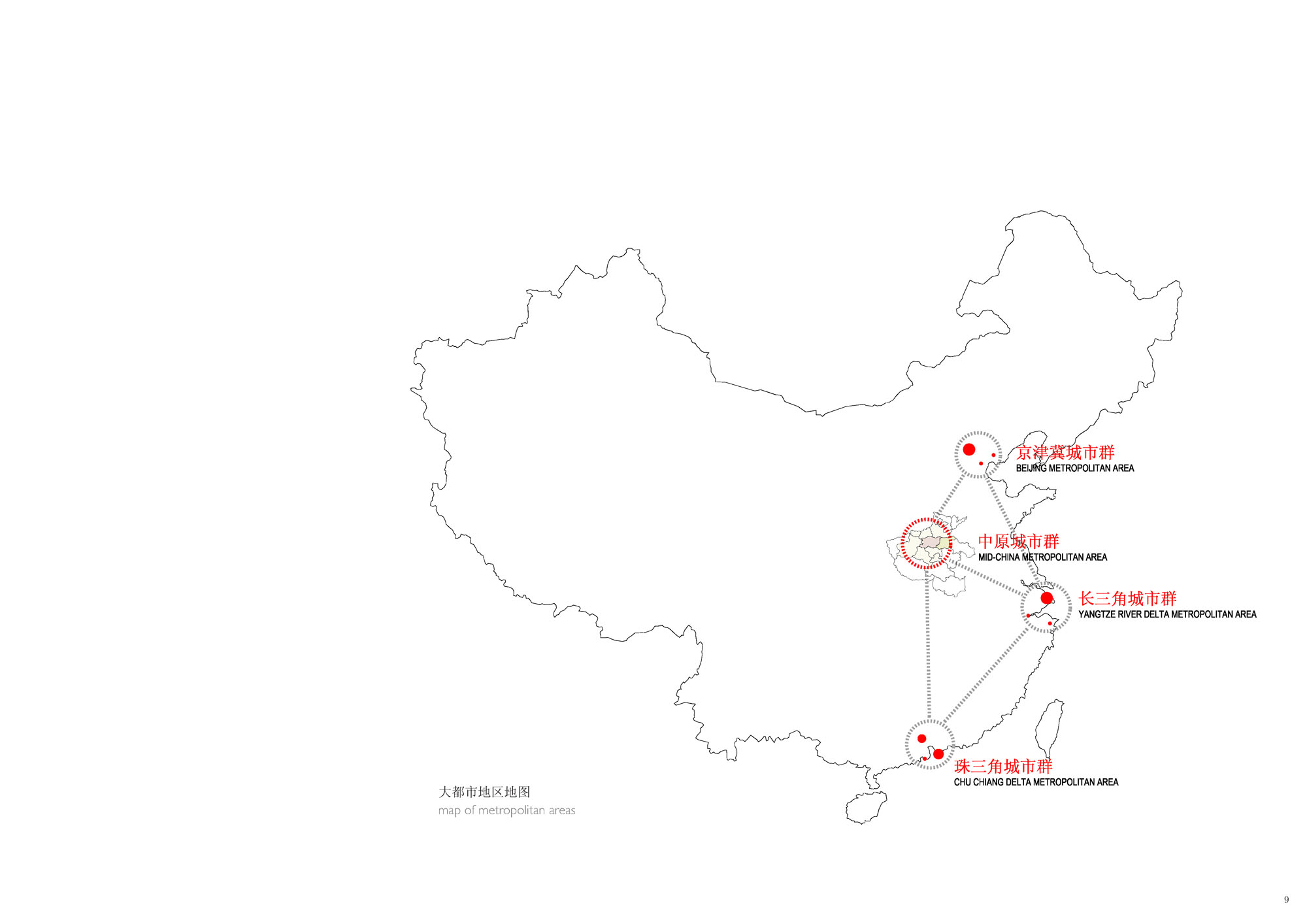
The planning proposal for the District of Baisha falls within the context of a set of large-scale urban interventions which the Chinese government has started up in the city of Zhengzhou (Henan) for the urban development of the interior of the country, near the Yellow River – the cradle of Chinese civilisation. The District of Baisha, up to now a farming area with a few small villages crossed by a number of canals, will boost development of the East-West axis which communicates the current centre of Zhengzhou with the nearby historical city of Kaifeng.
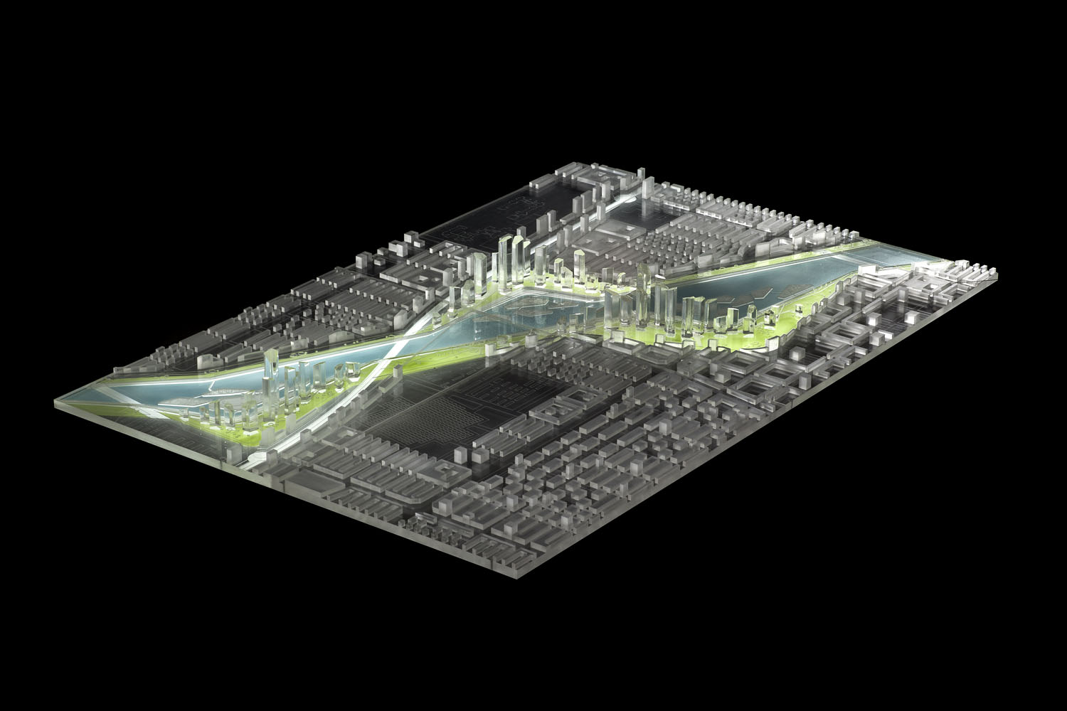
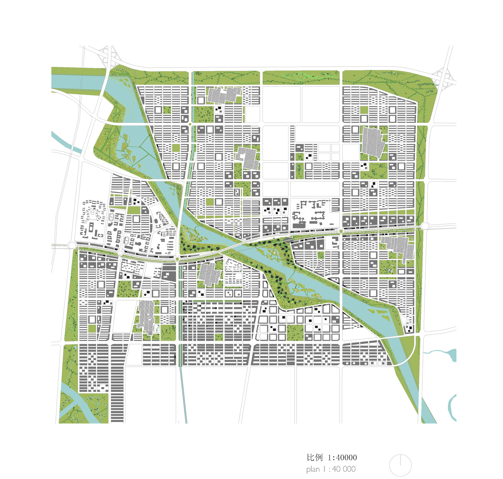
The project implies the development of an area with a population estimated in 500,000 in 2020, covering a total of 42 Km2, of which 11 Km2 correspond to the central area, the main scope of the tender. The prevailing use will be education, research and industry associated to new technologies, but it will also have to host residential, administrative and commercial buildings, as well as the necessary complementary city services.
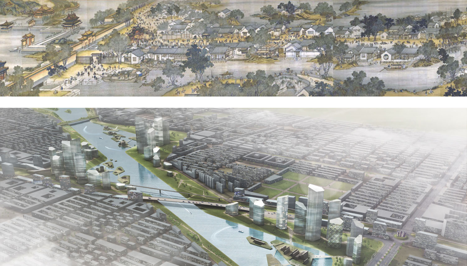
The main objective of our proposal stems from the conviction that the speed with which new cities are designed, developed and built in current Chinese society should not be incompatible with the concept of public spaces as justification and support for spatial and social preoccupations in new urban projects. If there is a common denominator of the Yellow River civilisation and, therefore, of the populations of the region of Henan in the past, this is undoubtedly water in all its facets: farming, hygiene, trade, culture, transport and communication, etc. A historical picture of the nearby former capital of Kaifeng – masterpiece of Chinese art – represents the concept of medieval life around the river and canals and expresses, perhaps better than anything else, the guiding inspiration behind our proposal.
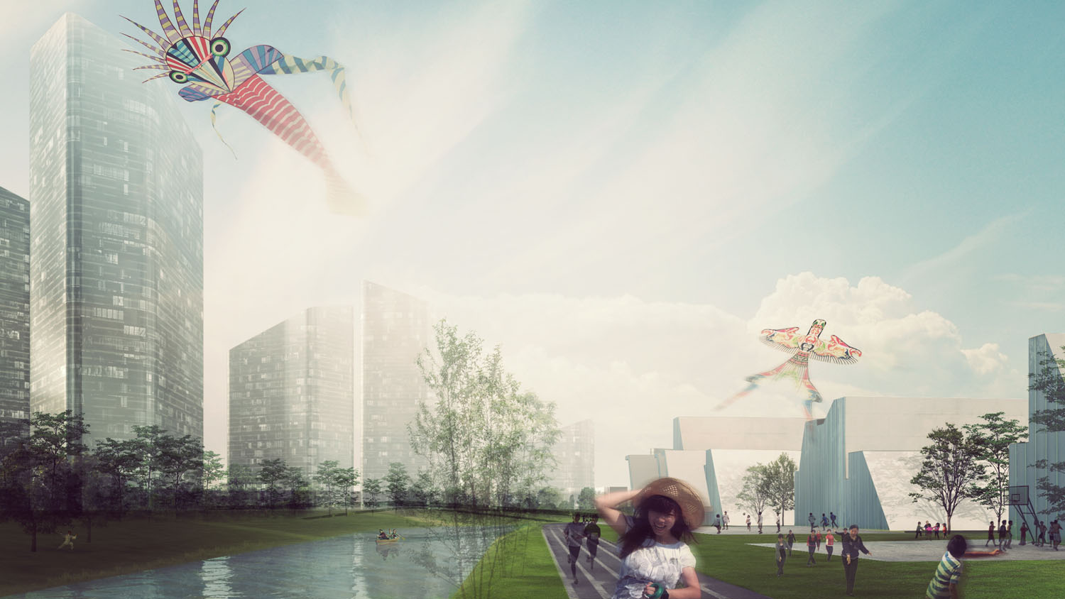
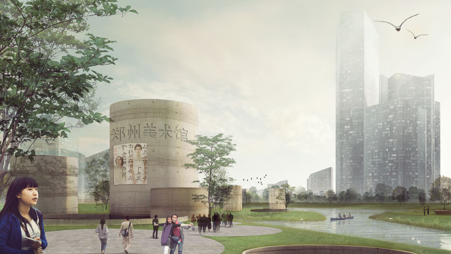
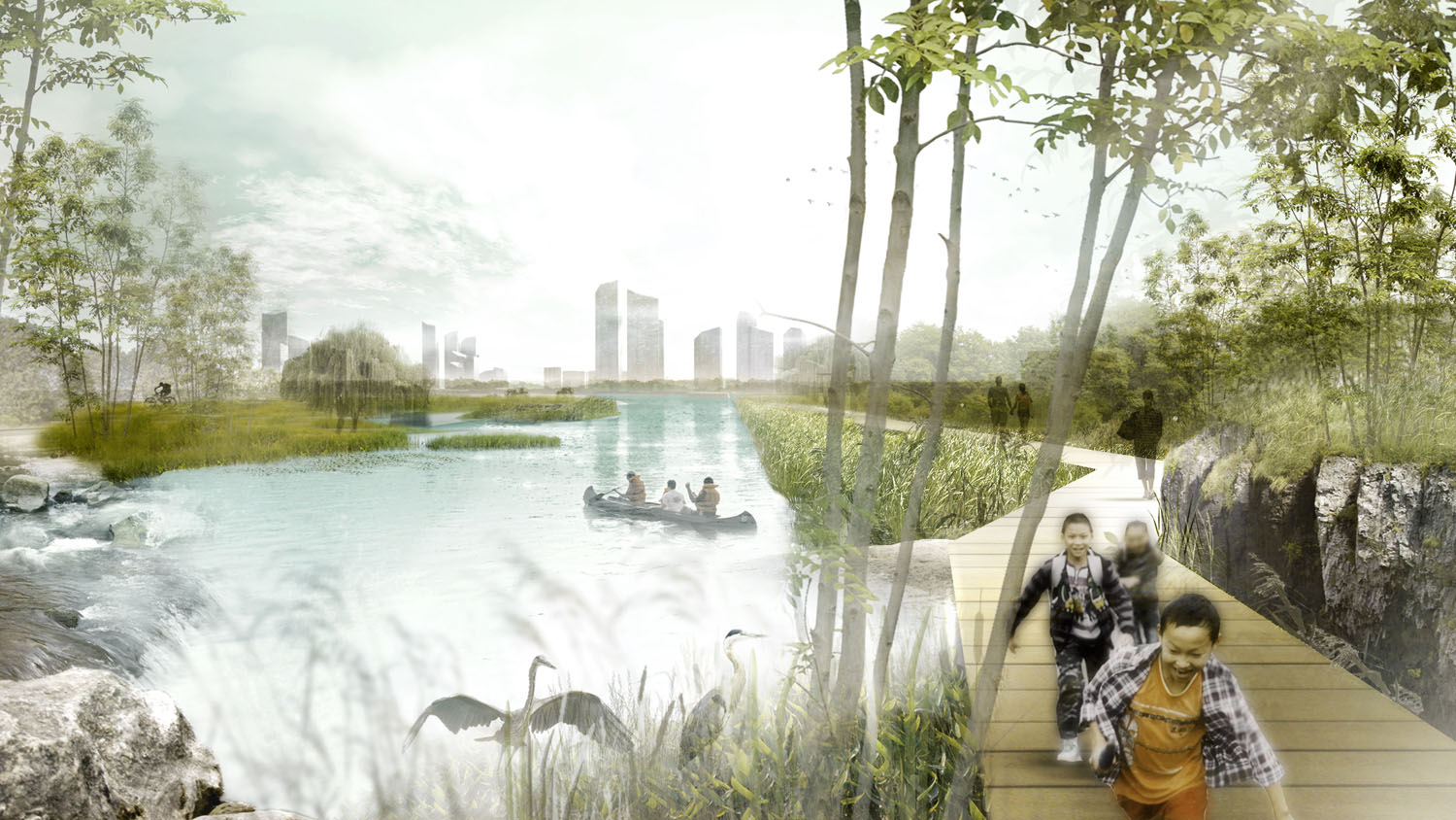
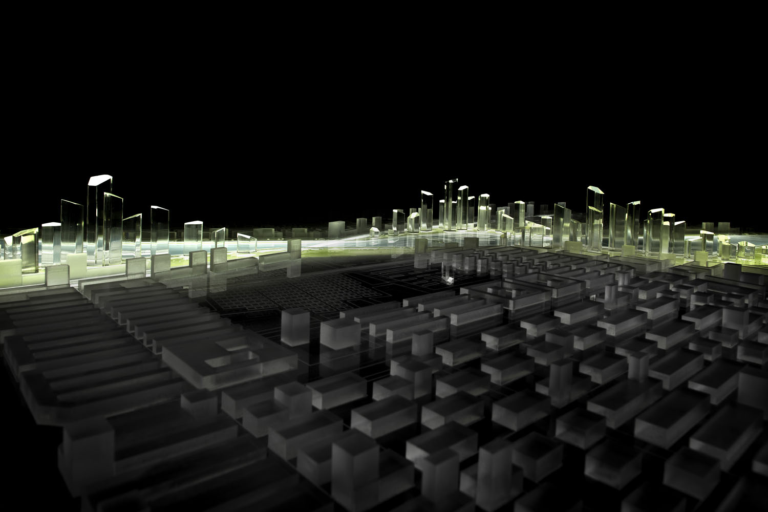
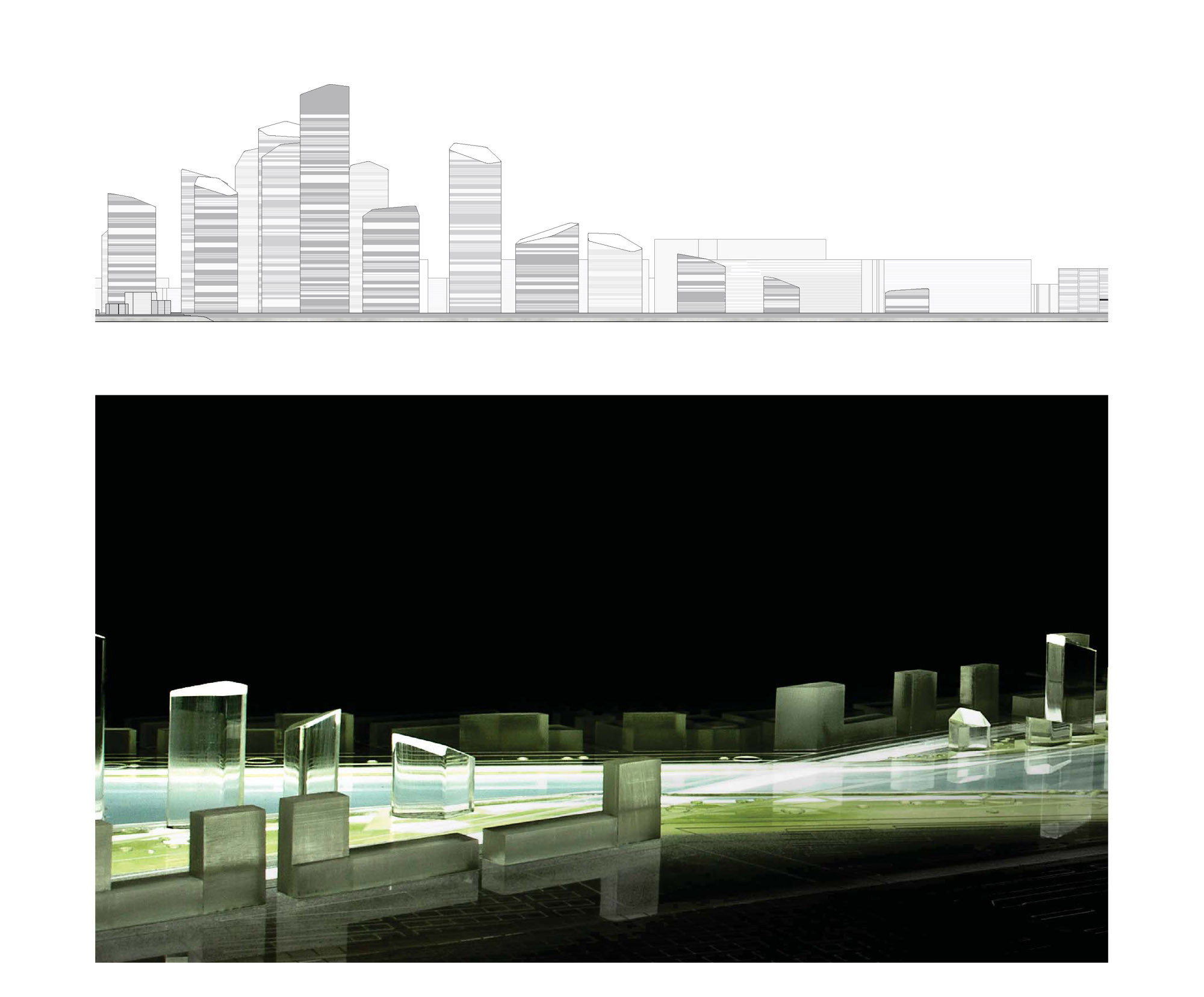
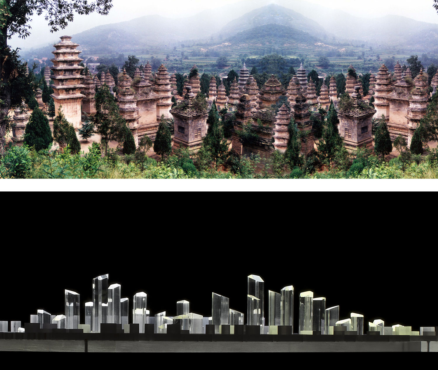
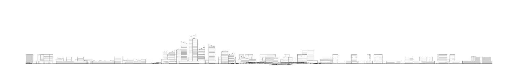
The Jialu River (tributary canal of the Yellow River) which crosses the area of intervention, becomes the leitmotiv of the project, a backbone whose limits we modify, widening the course of water to generate a set of artificial islands which pool the cultural, sports and leisure facilities. In this way, the water structures and orders the surrounding area, articulated around a large linear park which favours a sustainable and ecologically viable urban concept. The new skyline, defined by slim, multipurpose skyscrapers which sketch an undulating profile, and slowly descend in height, will mark the central area of the new district in the intersection between Zheng-Kai Avenue and the new linear park next to the river. Around them, the traffic infrastructures are arranged together with buildings of different dimensions and public areas near the islands concentrating the cultural, sports and public facilities.
The urban planning of the District of Baisha will contribute towards offsetting the enormous density which characterises new Chinese cities, with architectural and environmental quality of public spaces, recovering the identity of the former water canals, in a dialogue between memories of the past and the high-speed transformation being faced right now.