☉ Guidonia Montecelio is a proposal by Collaborative Architecture Makers for Comitato Risanamento Ambientale di Guidonia designed in 2015. It is located in Rome Italy in a countryside setting. Its scale is extralarge with a surface of 80.000.000 sqm. Key material is vegetal. The concept of renaturalization is explored.
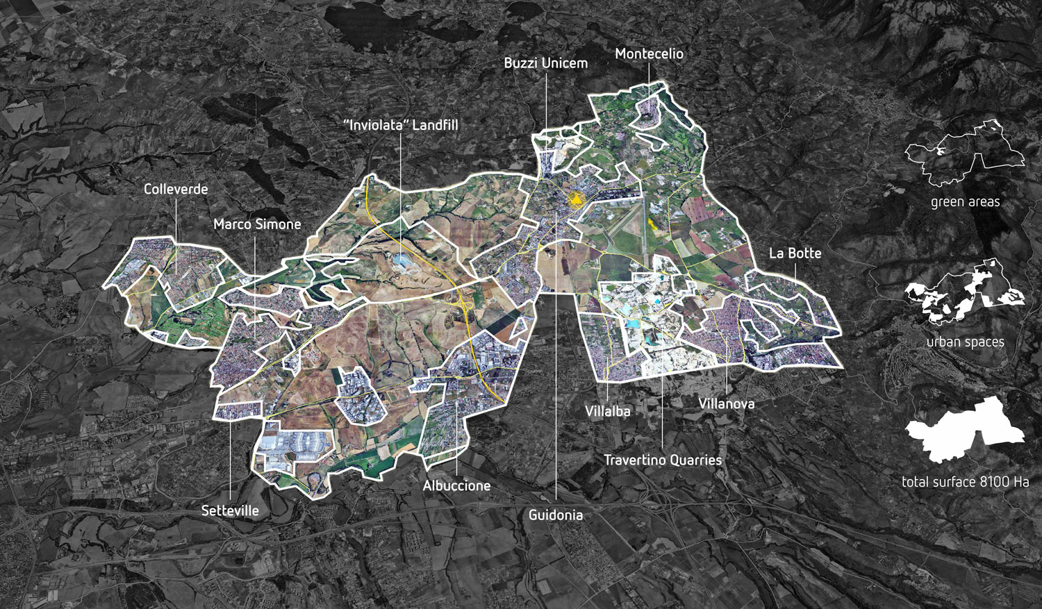


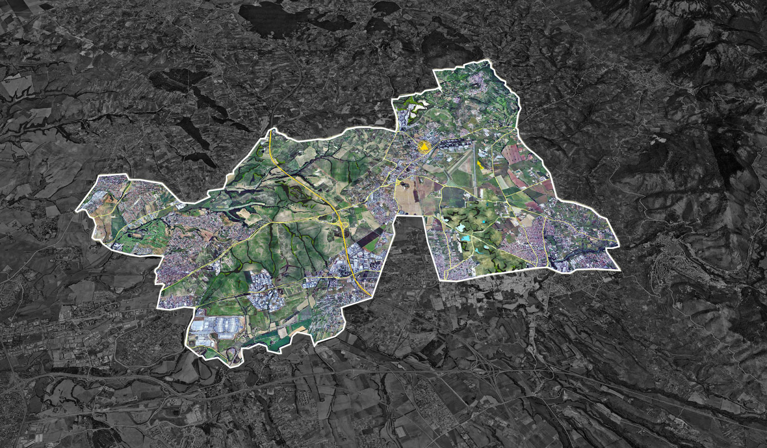
Guidonia Montecelio is a town of 88,435 inhabitants belonging to the metropolitan city of Rome, 22 km northeast from the capital. It is the third most populous city of the region and the second most populous non-capital city in Italy. Its territory, extending over 80 square kilometers, is the result of the agreement to unify under one administration, in 1937, the town of Montecelio and its military airport, the city of Fascist foundation Guidonia, of the areas of the Plain of Tivoli and some agricultural zone on Roman border. After the war the municipality had a dramatic increase in population, due to the growth Roman hinterland on extensive grounds of the «Agro Romano», followed by strong industrial presence and commuting, with environmental and social problems arising from a lack of attention to urban planning and services to the citizen. The population of Guidonia Montecelio increased from 40,000 in 1980 to the third city in the region surpassing the 80,000 inhabitants in 2010 and with a prevision of 100,000 residents in 2020. The development of the territory, fast and chaotic, marked by overbuilding and disconnected small new towns used as dormitory because cheap compared to the nearby and more expensive Rome capital, it has made them lose the original organic character of a city equipped with all facilities and public buildings necessary for the life and administration of a new autonomous municipality.
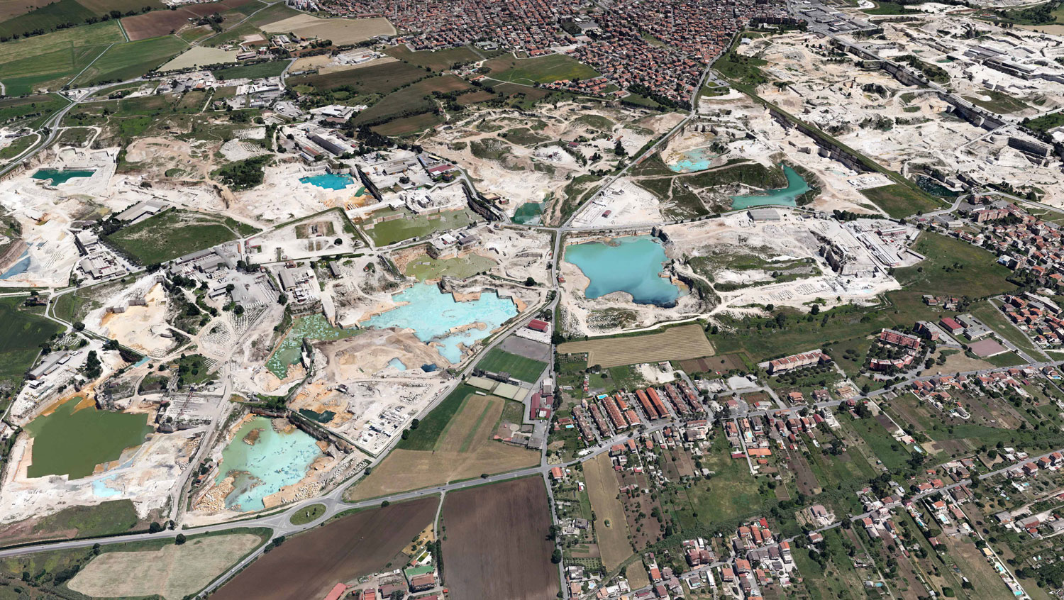
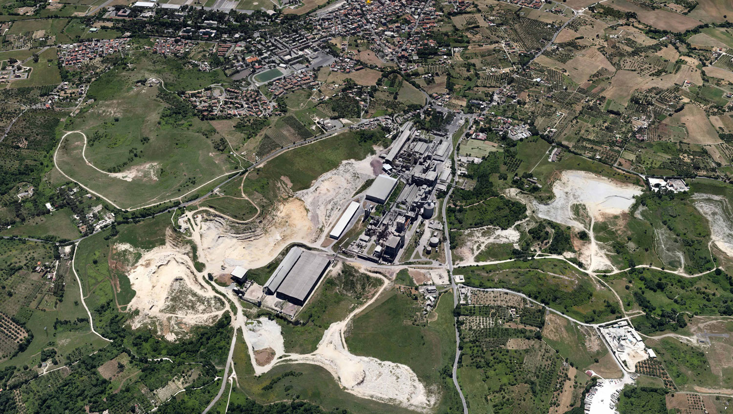
According to provincial data, the presence of various sources of pollution does not guarantee good air quality, this situation is aggravated by the cement plant Buzzi Unicem, which in 2007 represented the most impactful regional site in terms of CO2 emitted 1,084,450 tons. In the area there are also the travertine quarries that make increase the presence of fine dust in the atmosphere, but also create huge craters on both side of Via Tiburtina axis, they have direct responsibility on the phenomenon of subsidence (underground movements) and made that portion of territory unusable for buildings. Modern systems of excavation led to the depletion of historic and most valuable travertine, while all the water pumped 24 h 24 and poured in the nearby River Aniene, it causes depression in the natural underground water level and river water pollution. The Lazio region has declared a state of calamity (2005) for the area hitted by the effects of subsidence, while the state of emergency was declared by the government (2006). These disasters were aggravated by the ‘profitable’ trading of wastes, with the permission for waste dumps and TMB in the Inviolata Landfill (within an area of archaeological value and natural landscapes) for companies ‘tycoon’ Manlio Cerroni (owner of the biggest landfill in Europe – Malagrotta), with strong contamination of the underground water, proved by ARPA Lazio. Moreover, in Guidonia there is almost no trace of green urban green areas: the nearly 90,000 inhabitants, despite having a large surface area, have very small woodlands. A recent regional study attests that in Guidonia there would be just 26 hectares of woodland, with a decrease of almost 86 hectares compared to 1990 (approximately 70% in ten years), on 8100 hectares of the municipal area!
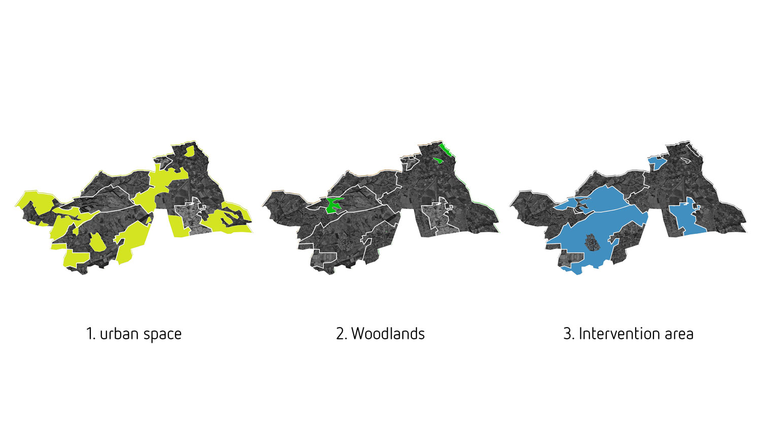
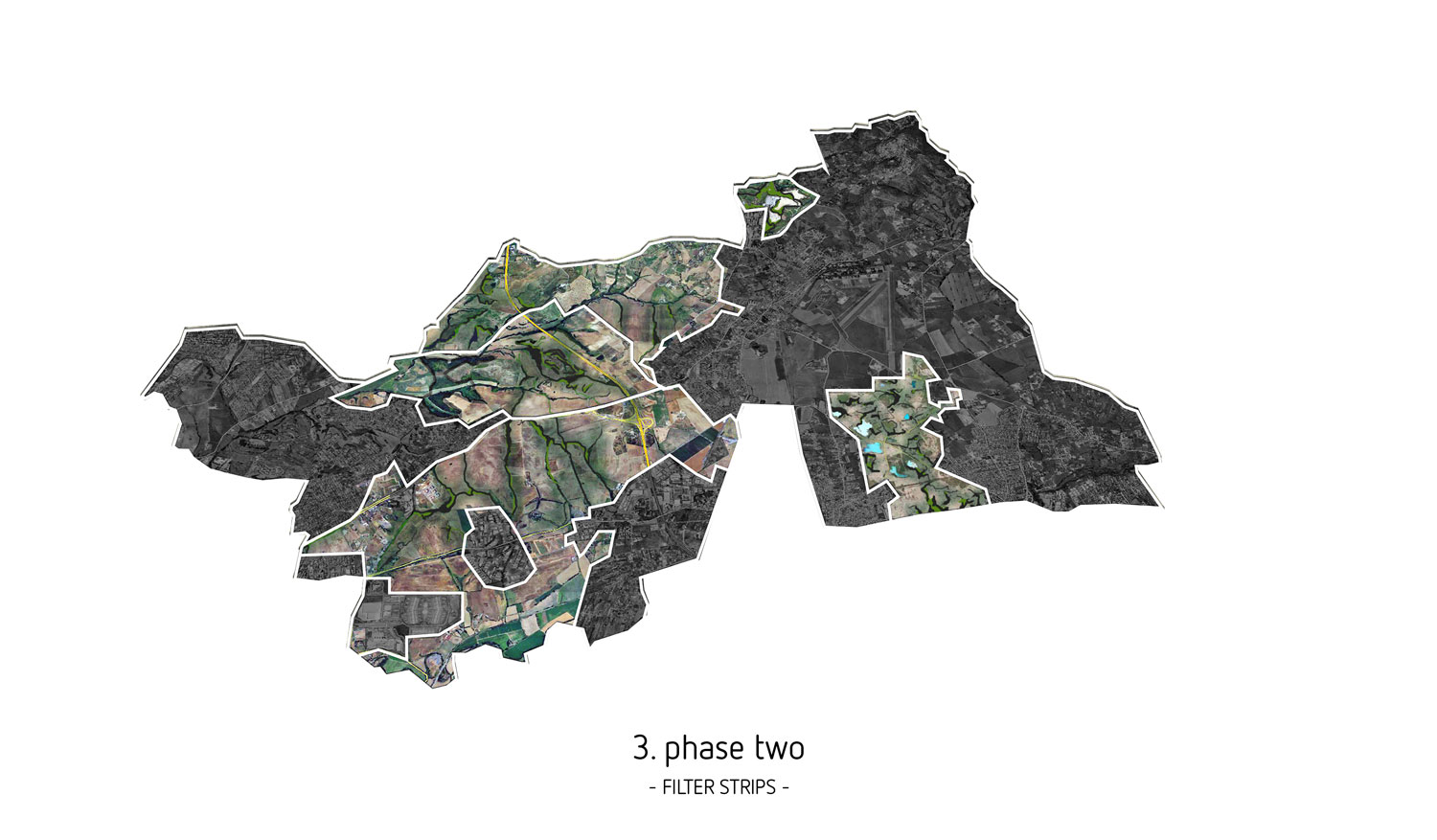
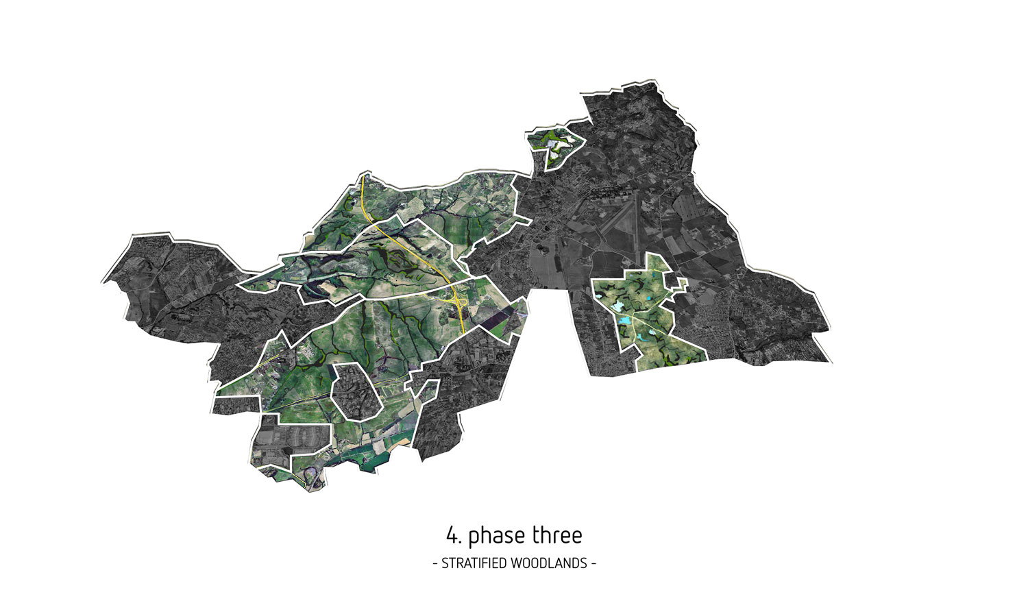
The exceptional natural interest of the Guidonian territory undoubtedly derives from its geological features, in contrast with the intense urbanization which it was subjected. Travertine is running out and it is time to start thinking about a different use of this territory that consumed almost all its non-renewable resources, we should begin to value those that are not exhaustible, such as nature and culture. Working with the CRA – Comitato di Risanamento Ambientale of Guidonia – that includes various associations of citizens who has been fighting for years for the preservation of the environment where they live, we have developed a project for the re-naturalization of the territory. A manifesto for the future, opening the way for a new tendency in land use and environment protection, which could serve for the recovery of other highly polluted areas. During the study we had identified the following areas and phases of intervention:
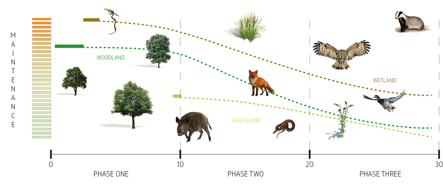
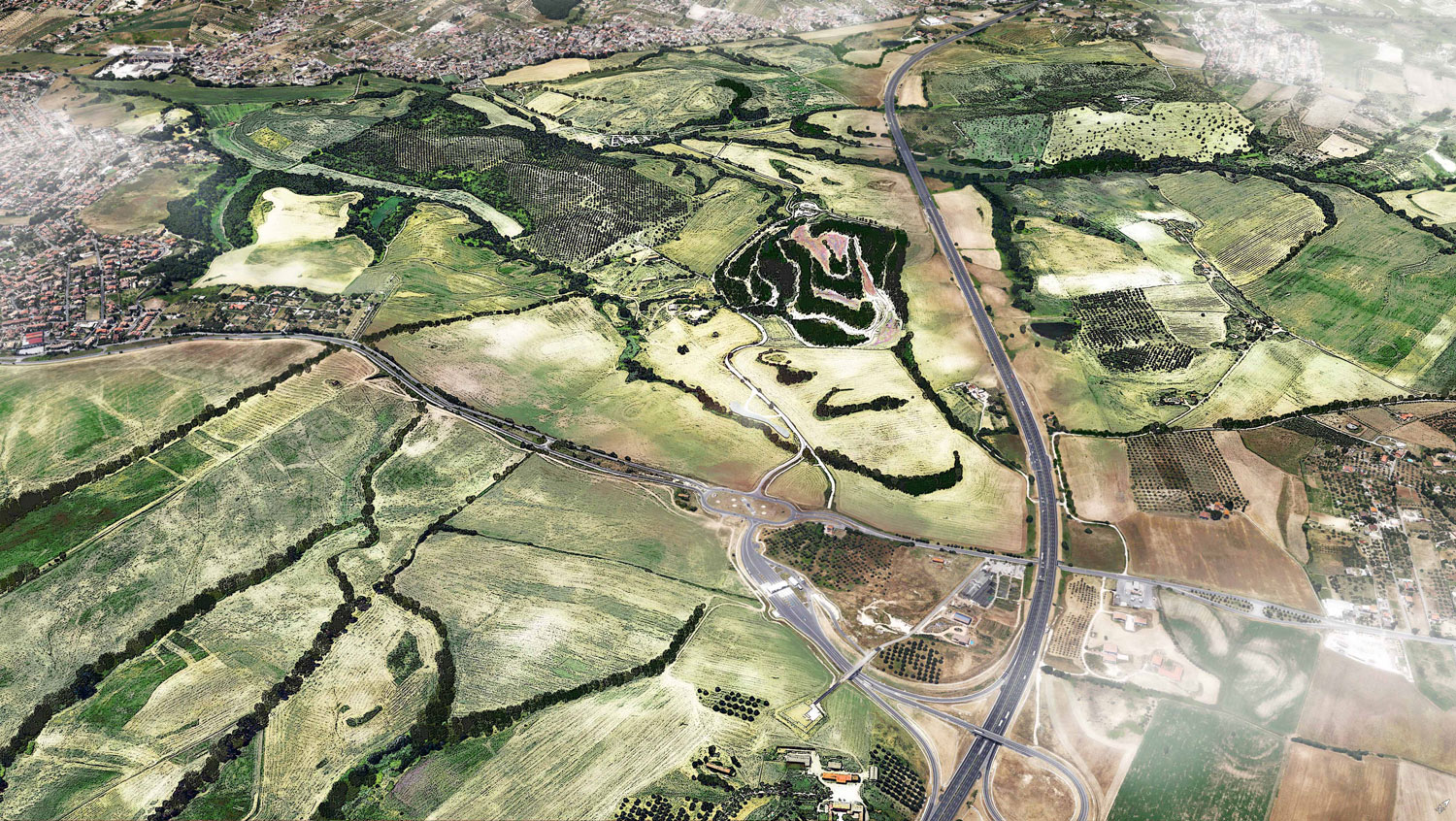
The area Inviolata urges an intervention to mitigate environmental damages created over 30 years by the second landfill in Lazio (a hill of 3,500,000 tons of waste). The area re-naturalized with local species of trees and shrubs and interconnected with the surrounding green areas, over a period of 10/20 years will be newly free of pollution and usable by the citizens. Following the example of our awarded project for the «Malagrotta Landfill initiative» in Rome, we suggested to start a 3 phases process in which only the first undergoes the human intervention and is followed by a spontaneous re-naturalization of the area.
The calendar includes:
– works on physical containment and surface isolation of waste with subsequent planting of the plants to be used to begin recovery;
– observation of the times of the «colonization» of the area by new plants and animal species;
– creation of a park as a natural island in a heavily polluted area.
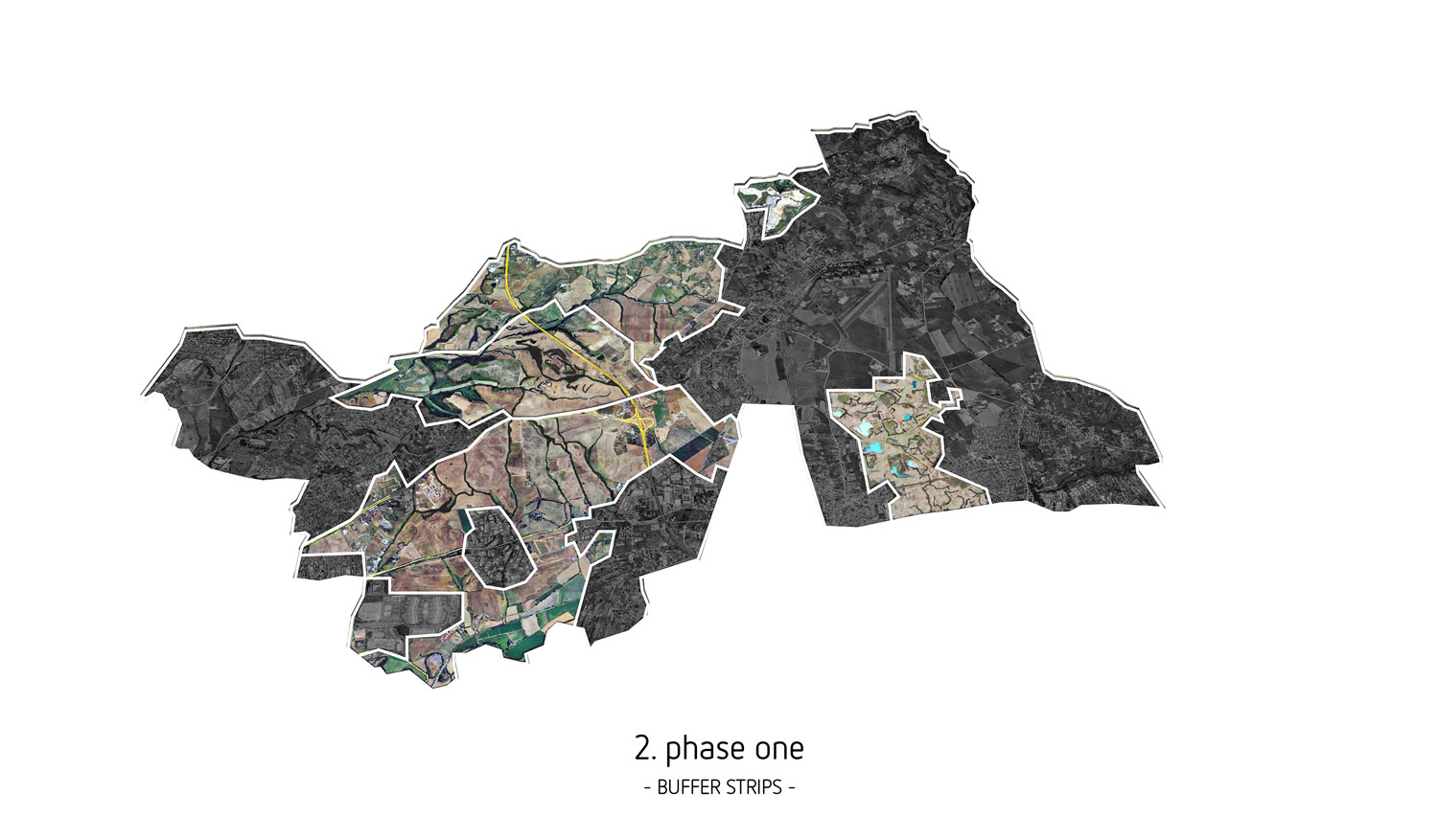
The colonization of the area will be helped by the creation of «buffer-strips», strips of biological connection extended to neighboring municipalities that by connecting various green areas will facilitate the recovery. As result of the CRA years of protests the landfill was closed on February 2014 and on the 6th of August 2015, the Archaeological Superintendence of Lazio has defined as «significant public interest site» (Decree No. 42/2004) 1500 hectares of land around Inviolata. For the River Aniene we planned the creation of a new suburban park in connection between the edge of the river and the surrounding villages (Villanova, Villalba, Tivoli Terme, Bivio Guidonia and Villa Adriana) with walkways and nature trails, in continuity with the Roman Aniene Park. A macro-landscape intervention composed by many micro-landscape interventions, such as new planting of aquatic plants with filtering properties or restoring natural bays along the river destroyed by human intervention to diversify the ecological habitat both on wetlands and on water. All these interventions have the goal of an independent development of the river over the years to come with no need for further action by humans.
For adjacent travertine quarries as Buzzi Unicem cement plant, will be settled up a table for discussion involving all the stakeholders, with the ultimate goal a common solution on the recovery of the heavily polluted areas, with a sustainable downsizing of the cement plant and the end of activities for quarries. As possible future scenarios to be discussed by the stakeholders we suggest the examples of the sculpture park La Palomba in Matera (recovery of tuff quarry), the project by the Politecnico Lausitz (IBA recovery of quarries in the Ruhr in Germany, turned into a wetlands park) or marble quarries Dionysos (transformed into open-air museum in Attica, Greece). The Via Tiburtina axis connect the residential areas of Guidonia and Tivoli with the capital, is surrounded by places of cultural, natural and archaeological interest. The Baths of Albule Waters, the travertine quarries, the Site of Community Interest «of travertine», the Aniene River, the complex of Ponte Lucano and Plauzi Mausoleum, the Emperor Adrian’s villa and the other villas of Tivoli (UNESCO world heritage), deserves to be organically developed from the touristic point of view, improving connections with the capital and trying to reduce traffic on inadequate Via Tiburtina, should be allocated in the center of the road a quick, public and sustainable transport way up to Rome.
The project has been developed with different specifications depending on the areas of intervention and designed to integrate different types of park:
– The Post Industrial Park. Buzzi Unicem or travertine quarries will be treated as «industrial monuments» to be conserved, at least in part, even after they have been closed because of great-looking and able to remember the industrial past of the area.
– The Natural Park. Created to preserve the natural habitat of the area with large areas where nature is left free where will be possible to see the great variety of plant and animal species.
– The Agricultural Park. To retrieve the agricultural vocation of the area and have an economic income by establishing a farm managed by the municipality (Like in Emscher Park in the Ruhr area of Germany) with an educational farm aimed to the responsible use of natural resources, and to offer the possibility especially for young people to gain experience in agriculture and farming.
– The Park for Sport. Inside the park of the Inviolata many paths and trails are drawn with access from the surrounding towns. These tracks will allow citizenship finally to have a public place where to play and go for walks and outdoor sports.
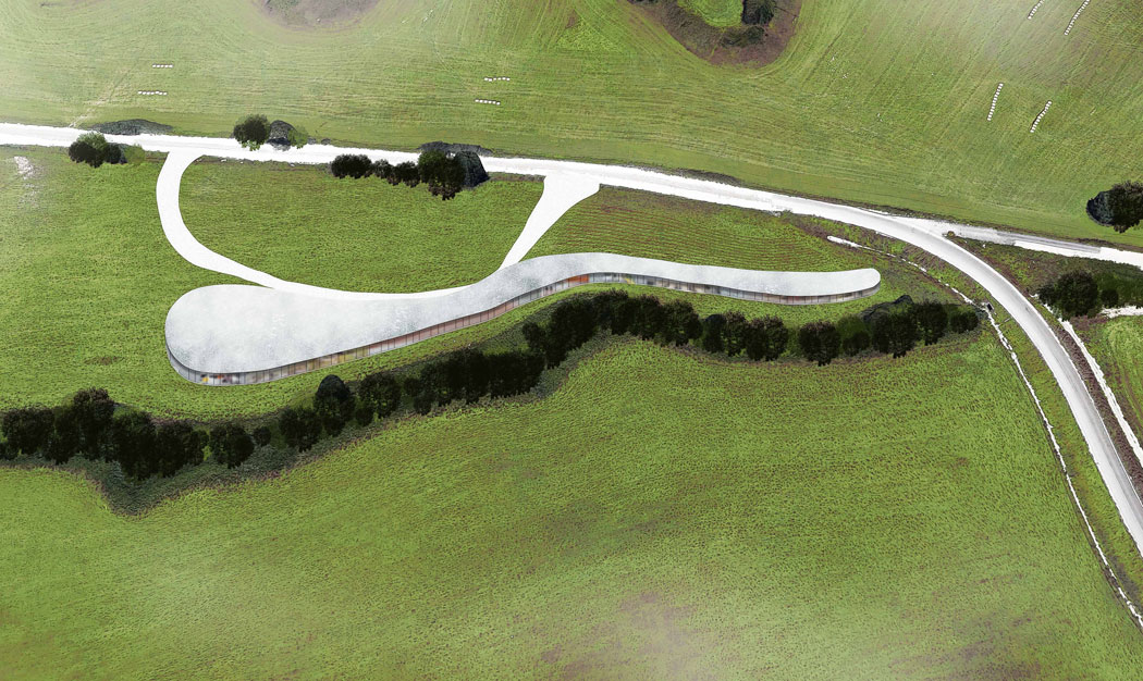
– The Events Park. The «visitor center» at the entrance of Inviolata Park will offer space for events, shows, exhibitions and fairs. A Technological space for innovation that will organize environmental education programs and will present to visitors the history, archeology and products of the Park.
– The Computerized Park. One of the most innovative elements will be the creation of a computerized system for managing both the vegetation and the communication with citizens, a web portal which will connect on one side gardeners, botanists, manager of the park and the other visitors on the other. Through this portal, all the events organized (cinema, theater, lectures and workshops) and natural ones (new blooms, migrating birds, agricultural products, production of honey, burn pruning, etc ..) will be communicated to the citizens. Fundamental to create participation and sharing.
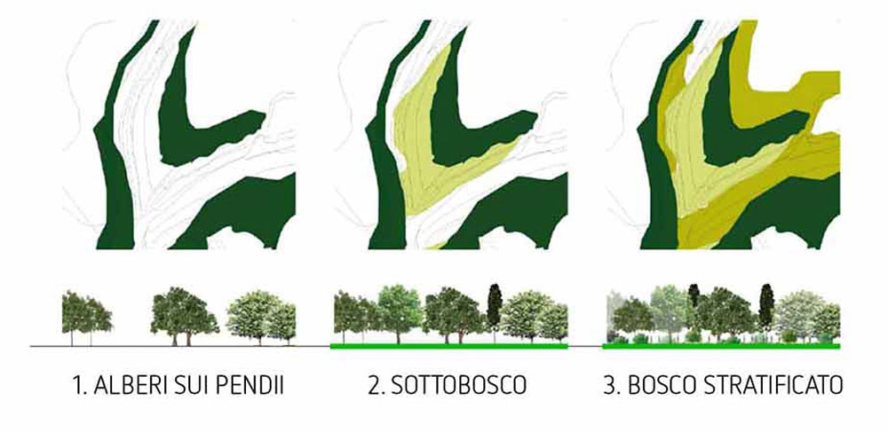
In addition to the preservation of the few remaining wooded areas or the recovery of the polluted ones, the project includes the introduction of new urban green areas that bring with them the old problem of maintenance costs. We proposed a new concept of urban green spaces, which considers its creation and maintenance not as separate phases. Including maintenance in the project changes a lot the way to plan a park. The concept of preventive, corrective and conduction maintenance is used to demonstrate that the same service responds to the control and adaptation of the park, according to the needs of the users that change over time. The concept of the park tending to renaturalization is usable in the field of scientific research: the planting of a sufficient number of trees and shrubs is not followed by the long maintenance phase, but leaves, on the contrary, the nature be free. «Densify» the green, allowing the plants to work by reducing the concentration of carbon dioxide and producing oxygen, it is a current trend also in Austria and Switzerland. The presence of urban green areas and «buffer strips» will represent a new natural infrastructure of the territory, thus promoting the passage of animal and plant species and allowing an autonomous repopulation and renaturalization of the area, this is the final goal of the project.