☉ Copa Cagrana Masterplan is a proposal by AZPML SHARE architects and YEWO Office for WGM Vienna Water Management designed in 2015. It is located in Wien Austria in a riverside setting. Its scale is extralarge with a surface of 93.380 sqm. Key material is glass. SBDA collaborated as visualizer. Concepts such as new development and densification are explored.
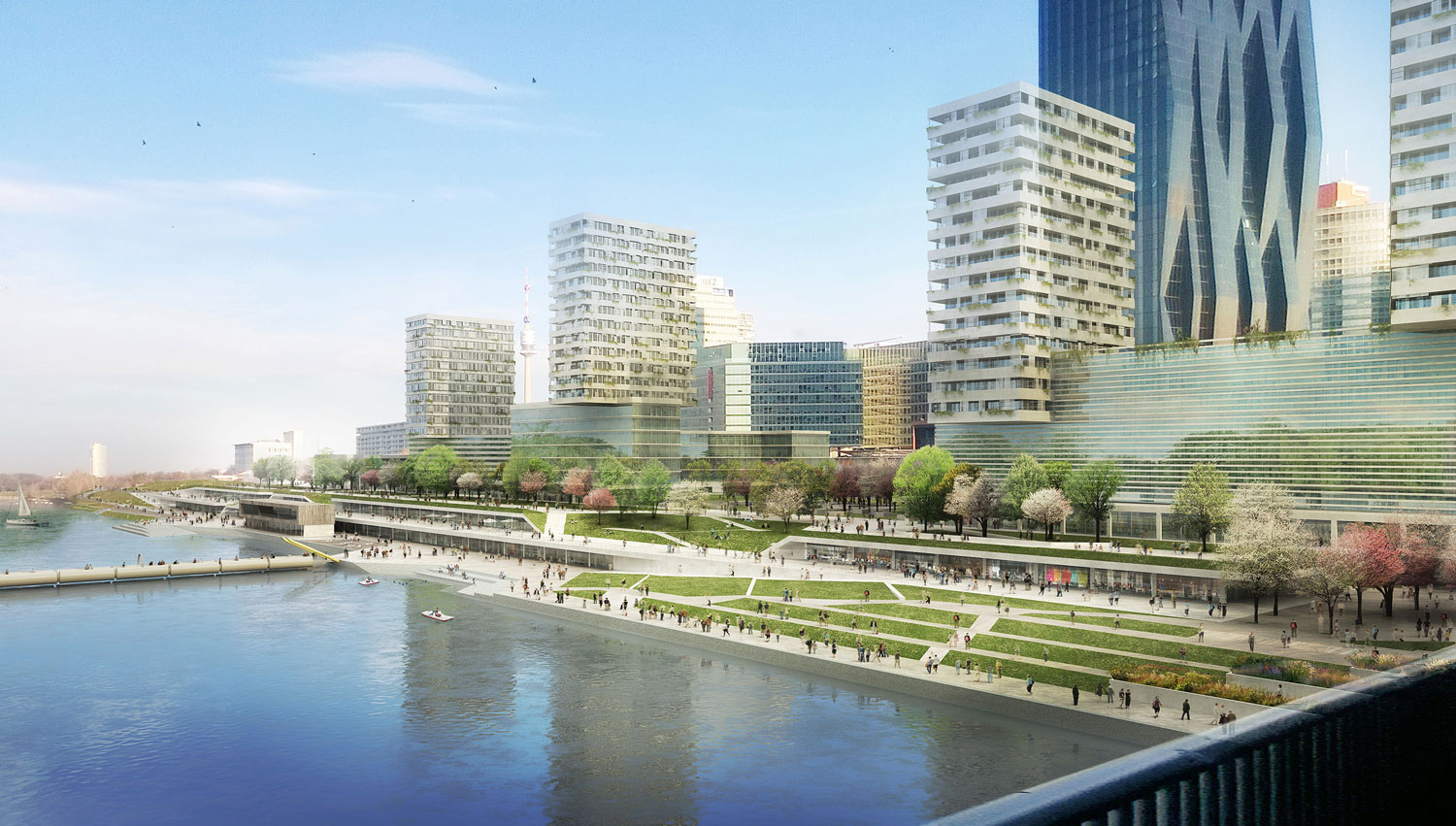
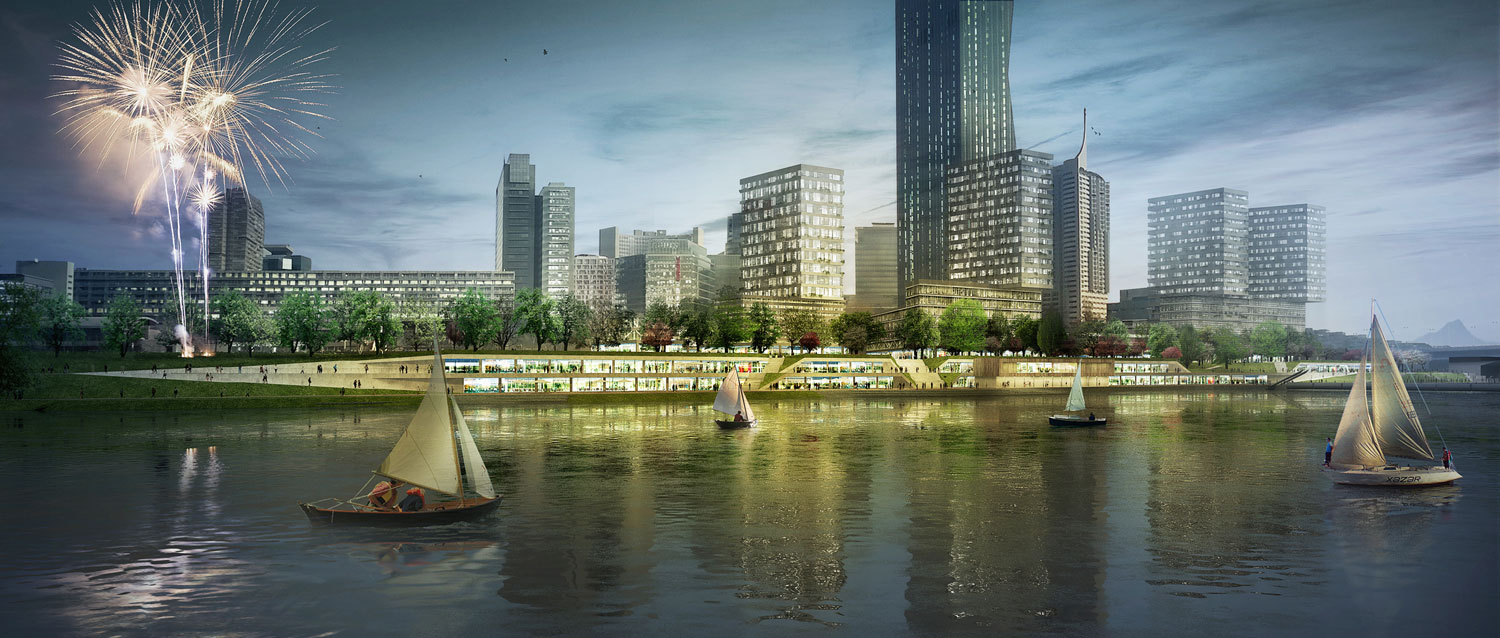

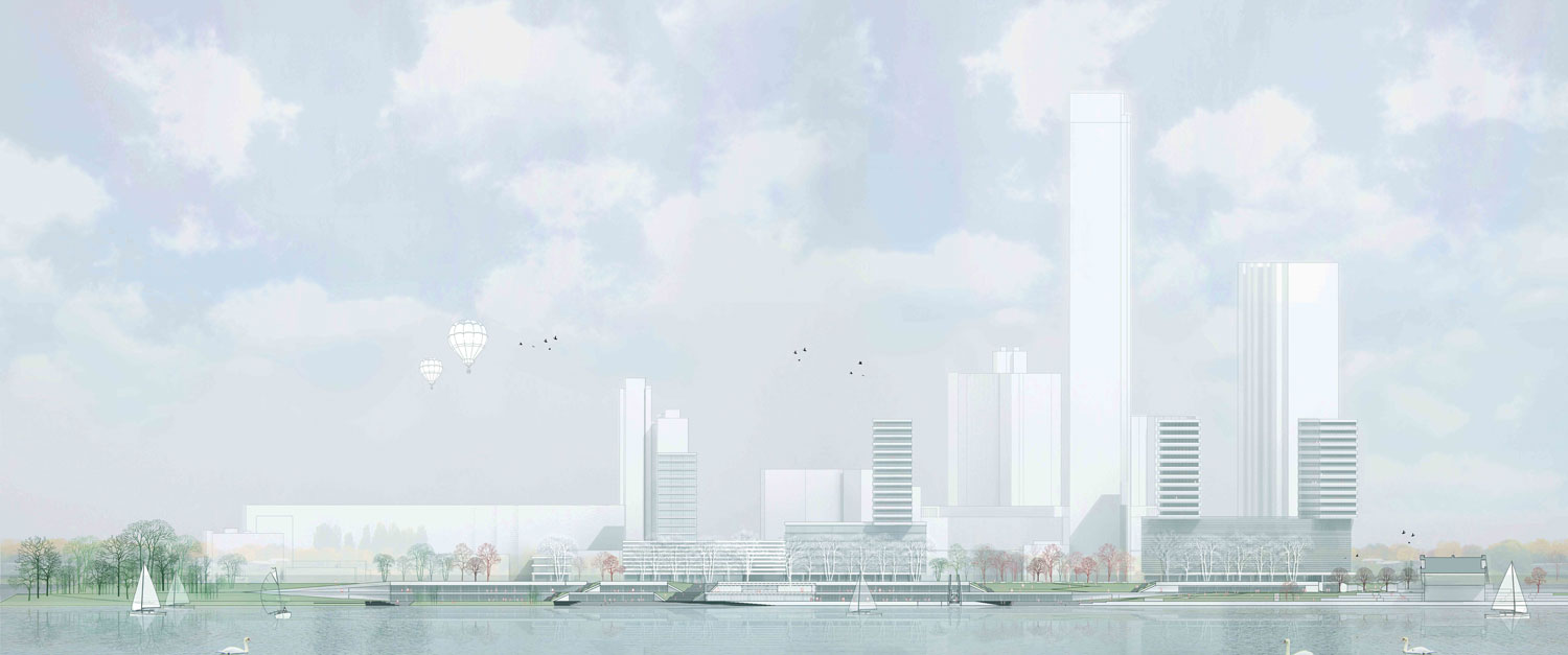
The Copa Cagrana Quai on the Danube Island presents a fantastic opportunity for the creation of an important piece of the urban realm in Vienna. The adjacency to the UN City and the new DC towers and the area of dense urban structure surrounding it, plus the new desirability of residential quarters along the river, and the fantastic level of accessibility which is provided by public transport, suggests that this could become one of the most significant riverfront locations in Vienna in the future. Unfortunately, the opportunity seems to have been endangered by the haphazard nature of the ongoing developments which do not seem to have been properly coordinated to take advantage of this opportunity. Our proposal aims to address a number of opportunities operating on different scales:
The general demand for densification in cities, and the use of brownfield sites. While the City of Vienna has unsuccessfully tried to attract cultural institutions to the Island riverfront for some time, there is undoubtedly a growing demand of residential buildings in Vienna, and the desirability of the riverfront locations is growing. The top of the Kaisermuhlen tunnel, which was designed to withstand a substantial building loads represents an extraordinary opportunity to densify the space between the UN City and the riverfront with additional urban program of hybrid nature, which will mediate between the urban density that has already been created by the UN City, the DC Towers and their surrounding development, and the riverfront promenade. In our view, without the insertion of additional program between the DC tower site and the riverfront, there will be no effective connection between the urban spaces in the UN City and the riverfront, despite the DC tower attempt to create a surrounding public space.
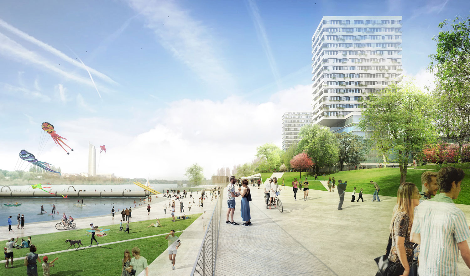
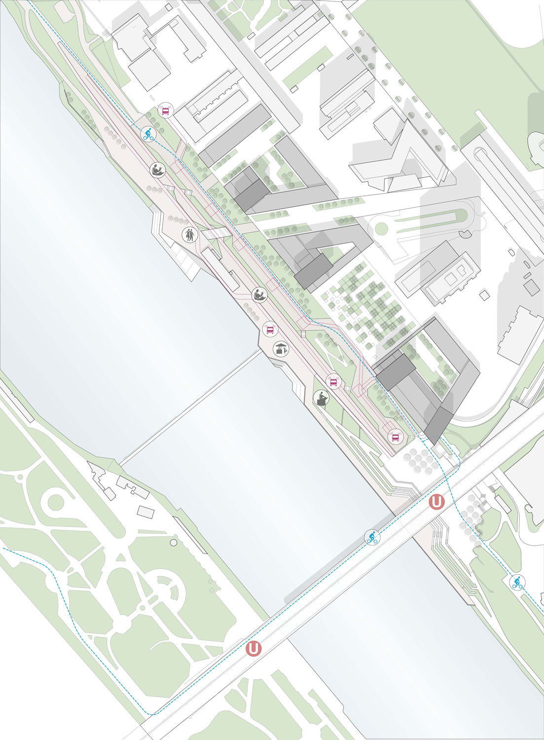
The Copa Cagrana site lies right next to the Donauinsel U1 underground station, and the landing of the Reichstagsbrücke Bridge, which provide excellent mass transit to the site. This extraordinary accessibility has become already an opportunity which has been haphazardly exploited by a group of, mostly temporary leisure facilities, from which some of them have started to consolidate physically in a rather random manner. If there is a location along the Danube Island riverfront where there is an opportunity to produce a more urban, more intense use is here, because the adjacent population and the presence of mass transit. While the riverfront could become a green, leisure oriented infrastructure in the city, Copa Cagrana should become its epicenter, and have a more urban character.
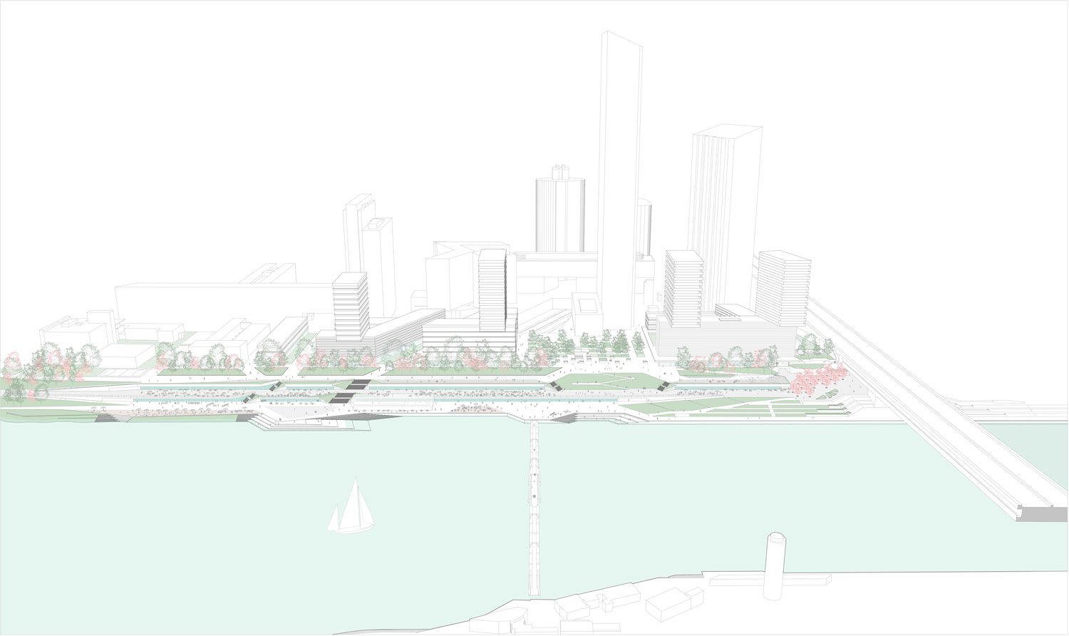
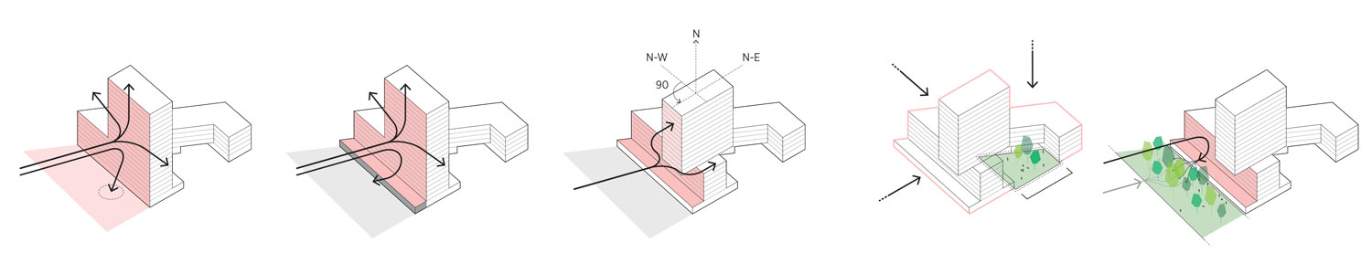
The Copa Cagrana site is exposed, like most of the riverfront promenade, to heavy winds and periodic floods. These intense climatic conditions have traditionally prevented a more intense form of urban development close to the river edge. The proposal needs to address not only the insertion of additional program, but also the creation of a more livable urban microclimate, where wind exposure is mitigated, flooding effectively considered in respect to programming, and the topographic solution to mediate between the public spaces which have developed on the +10 level, with those by the water. Our approach to the planning of this unique opportunity for the City of Vienna has been to treat the space as an urban infrastructure where different scenarios can develop in the future. We see our proposal as an attempt to provide an infrastructure for a dense central place along the Danube Island Waterfront: an urban enclave by the water.
Masterplan Structure
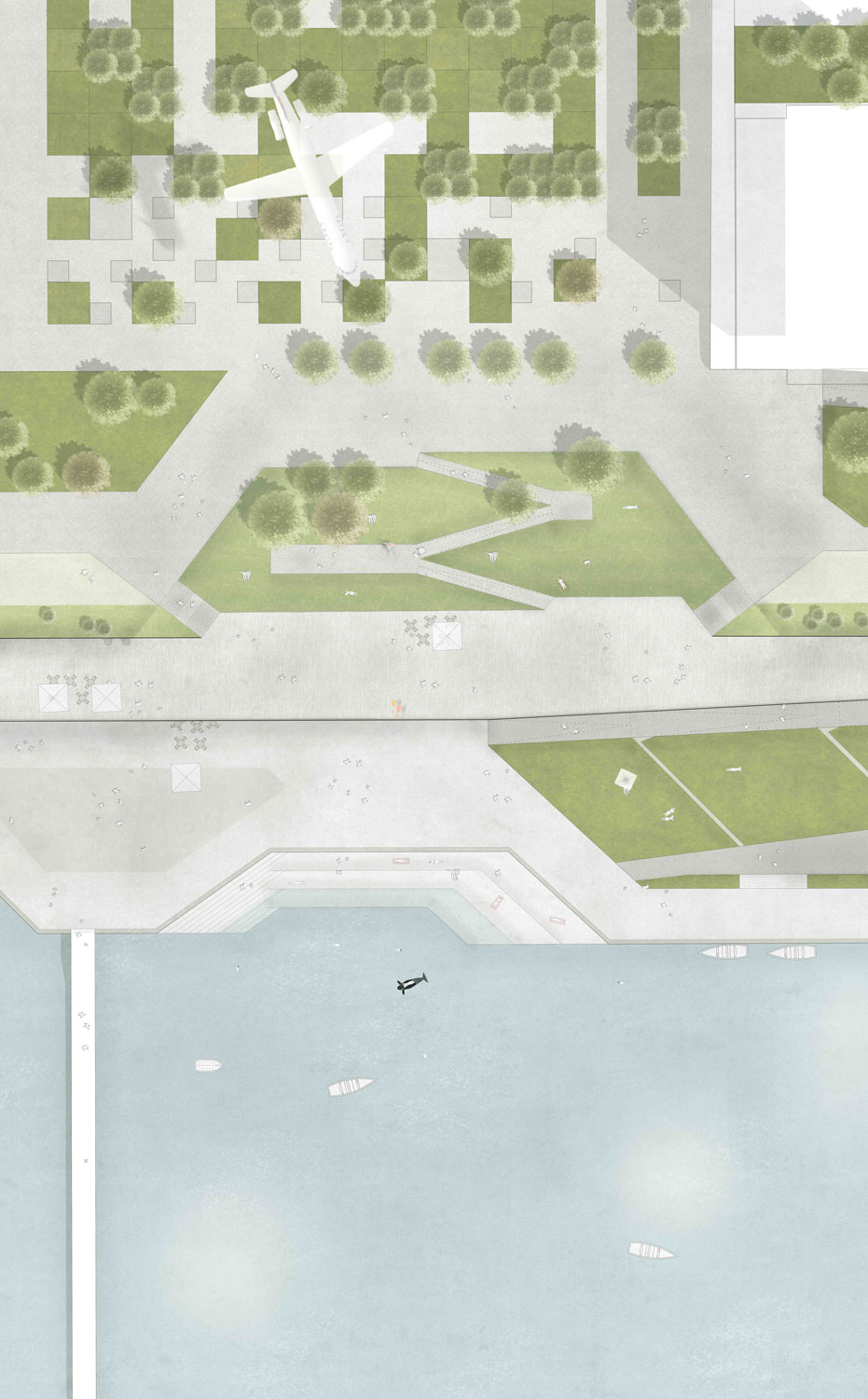
The masterplan has been structured with a series of layers which mediate programmatically, topographically and environmentally, between the urban core of the Donau Island, to the edge of the water:
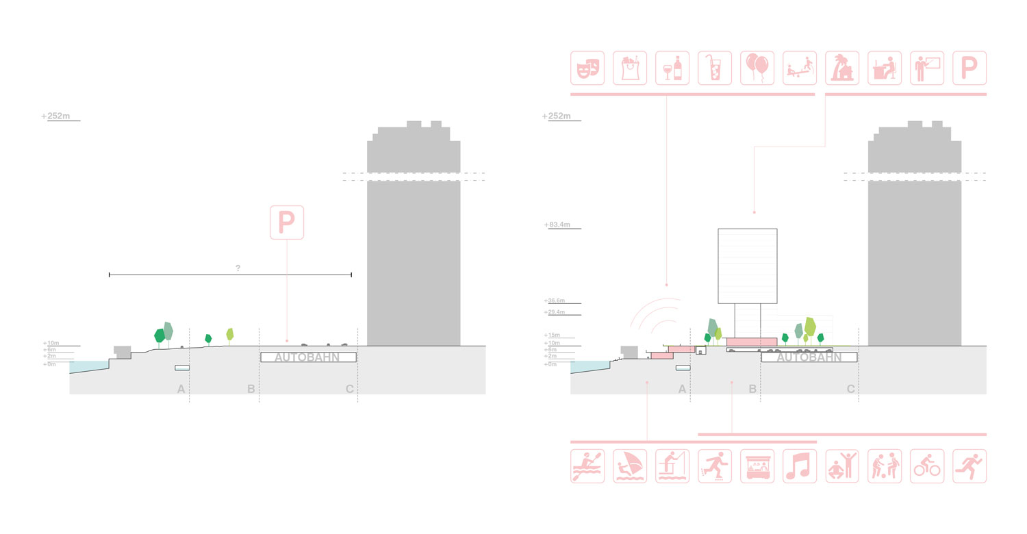
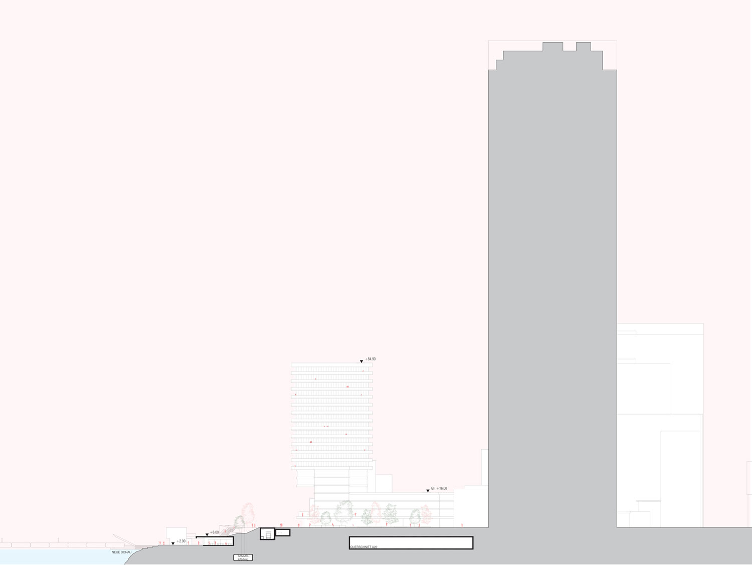
Zone C. Corresponds to the area occupied in plan by the Donauuferautobahn A22 Tunnel. The Tunnel has been designed to withstand building loads equivalent to 7 floor height buildings. We believe it will be a pity not to utilize this structural capacity to add an additional layer of density to the waterfront, to help populate the area with additional services and people. Considering the desirability of the waterfront for residential functions, the relatively low density of retail and leisure facilities north of the site, the proximity of mass-transit connections and the hybrid nature of the surroundings, we propose to introduce a band of urban fabric of mixed use character with a substantial proportion of retail facilities on the ground level, to animate the pedestrian level. We have designed the fabric to cover the entire width of the tunnel, plus a band of 24.3m to the south, with a zone of semi-closed blocks which will enclose open public spaces which will protect public space from the strong winds in the area. These spaces will form a sequence of semi-enclosed public spaces with an adequate urban environment, which will accommodate hybrid programs.
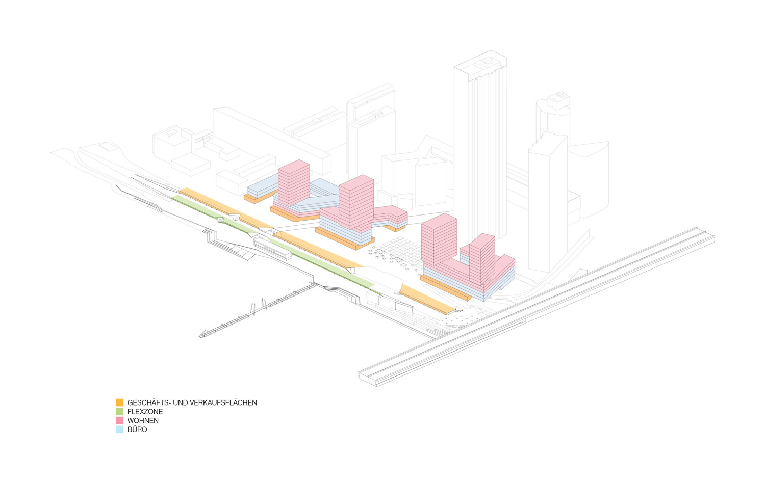
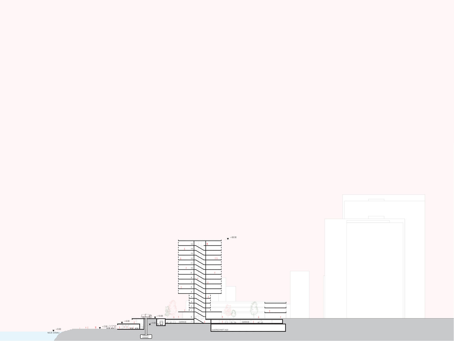
At this effect, the depth of the buildings has been restricted to two structural bays (16.2m) in order to provide naturally ventilated space suitable for domestic inhabitation or employment space. The floor to floor space is proposed at 3,6m, except on the ground level where we are proposing 4,8m in order to accommodate retail facilities. The height of most of the development will be around 7 floors, with a maximum cornice level of 26,40m, which can only be exceeded on the band on zone B, which can be grounded outside of the tunnel. On this band we have located 4 towers with a relatively small footprint and oriented perpendicular to the main Southwest wind direction in order to reduce downdraft. It is likely that the towers will be for residential use. The semi-closed blocks are provided with a projected socle, 8,1m towards the riverfront, in order to break the potential downdraft resulting from the buildings. The total amount of construction on this phase is 79,000 m2.
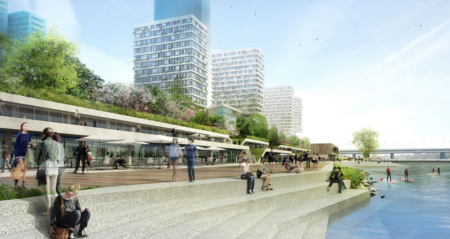
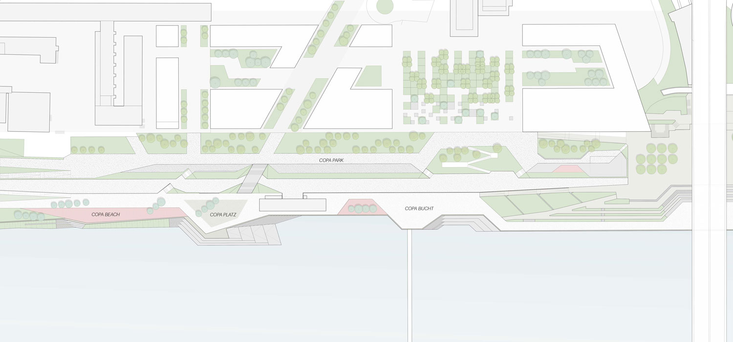
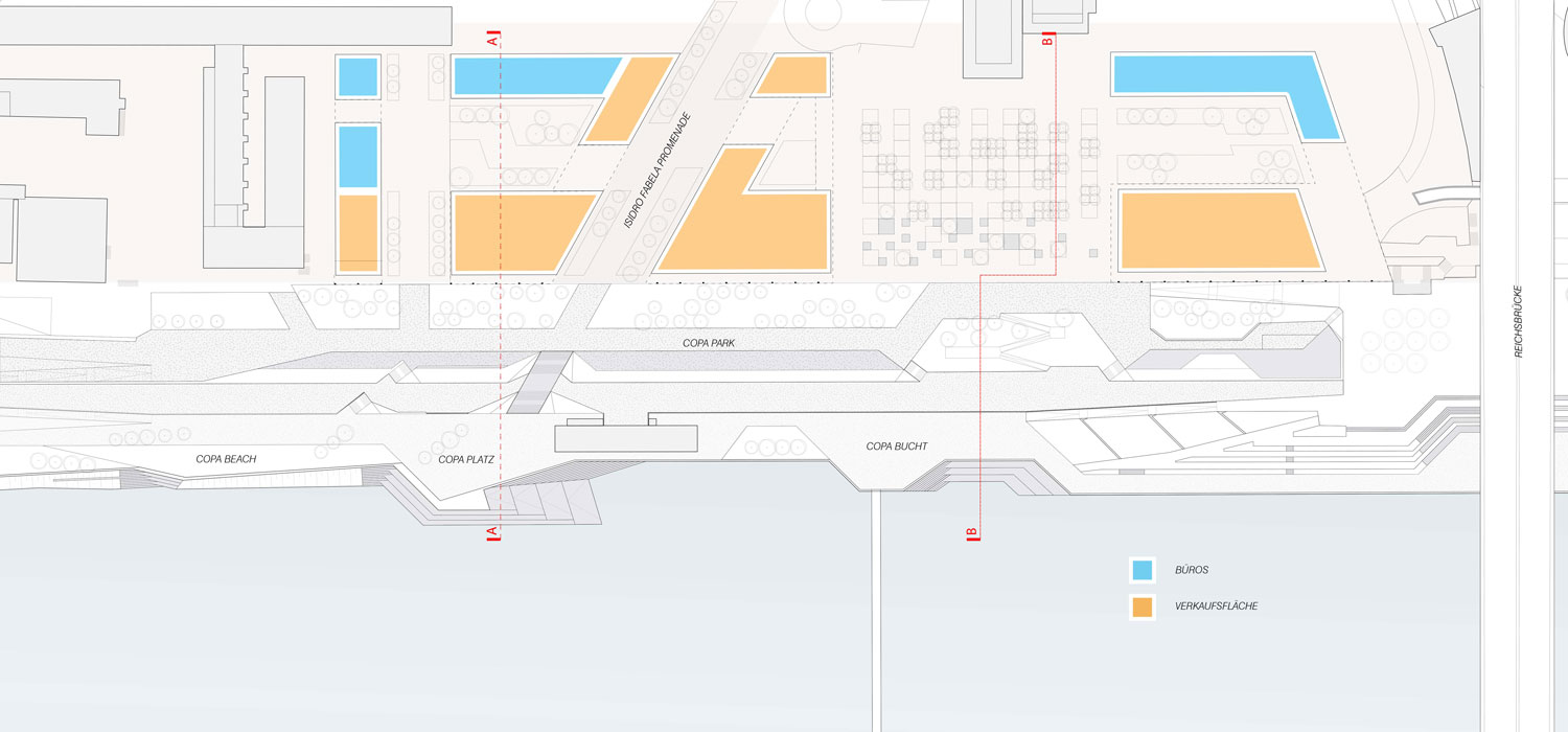
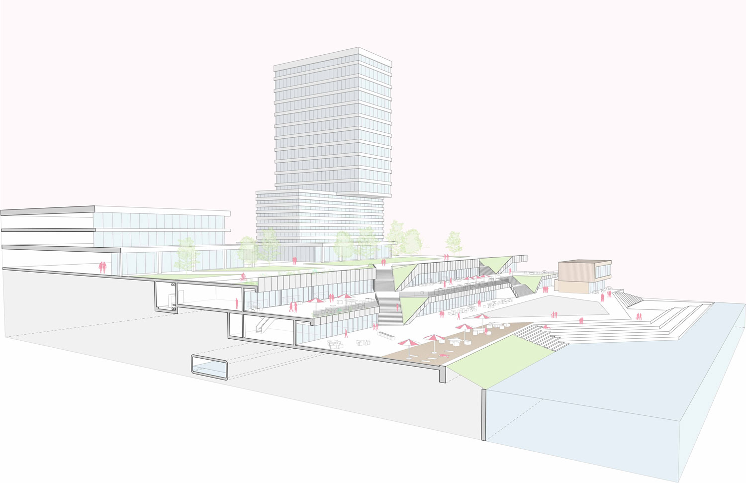
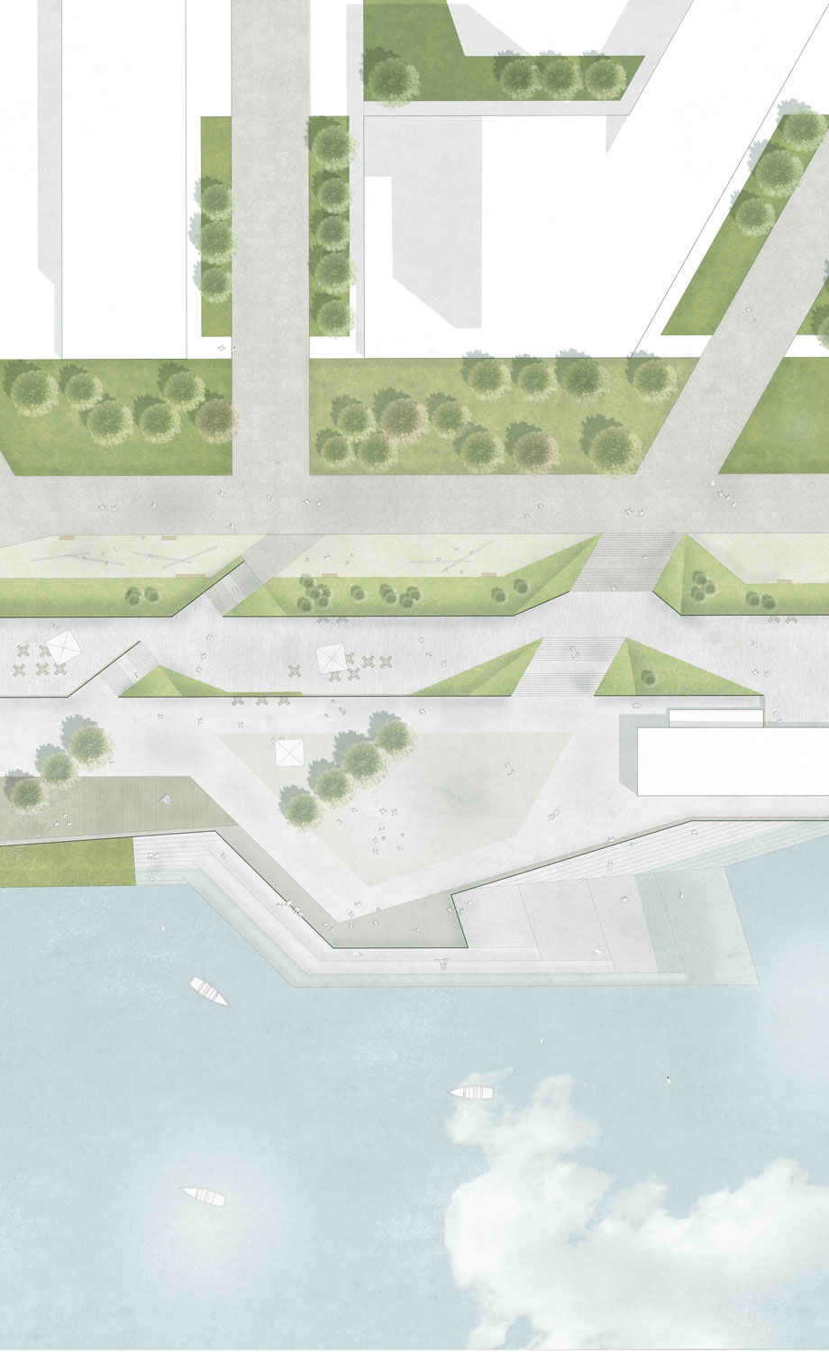
Zone B. On zone B we have tried not to extend over this area too much, building over the first 25m band adjacent to the tunnel, where there is already an existing car park structure. An extension of that car-parking structure along the southern edge of the tunnel may be adequate, to leave a 16.2m band of natural soil, where large evergreen trees will be planted in order to diminish the wind speeds along the riverfront. The landscaping on this zone will include as much green soil as possible in order to retain the rainwater locally, to produce the humidification of the air. Part of the 79,000m2 of mixed-use program we assigned to Zone A is located on Zone B. The southern part of Zone B will also be occupied by a band of retail program, 15.5 deep, accessible from a platform located at level +6. This program implies a total area of 4000m2, where the catering business that are no gathered haphazardly on the Copa Cagrana site will be hosted in an organized manner, above the 100 year flood plane, as an integral part of the new topography which will connected smoothly the +10m level, with the riverfront level at +2m. The new terrace, which will be servicing this hostelry program is located on Zone A.
Zone A. On Zone A we have located 5750 m2 of additional leisure oriented program, accessible from the quay level at +2m. Given the flood risks on this level, we are proposing to locate program which is either complementary to the one located at +6 —such as the case already happening in the newly built restaurant facility on the site— or devoted to functions which do not require delicate infrastructure: public toilets for the riverfront promenade, dressing rooms for sports, weights and sports facilities, hammocks and rowing boat rentals, Tai-Chi training, ice-skating, life-guarding facilities, children’s playgrounds… but also additional seats for bars or restaurants during the summer. The +2 platform will provide an ideal location for facilities which can be easily stored in waterproofed storage.
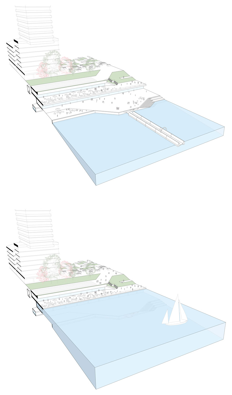
The public space will be organized in three levels with distinct qualities which gradate both topographically, programmatically and environmentally between the UN City and the DC tower zone to the water level. The three platforms that structure the public space are then connected through a number of ramps, stairs and mechanical devices which will facilitate the movement from the urban level at +10,00 to the quay level at +2,00. Level +2,00 is the level of the quay. The modification will be mostly on the re-paving of the ground, sometimes with pre-cast tiles and sometimes with wooden decks. Since this platform is likely to be flooded with a certain frequency, the functions that we have located in the active frontage are equally resilient and include public activities in the park. The active frontage will be built with tempered glass to avoid breakage in the case of flooding. We have avoided to place urban furniture or other delicate objects on this level. The level of programmatic determination is low on this area.
Level +6,00 is the level above the 100-year flood plane. A new reinforced concrete structure will be built to cover the more public functions below, and the paving will also be made with precast concrete tiles. This platform, which is 14.1m.-wide will be entirely occupied by the extension or business and cafes to the public space, activating the occupation of the public space. This level is aimed to host all the different facilities which are now sitting on the quay, which will be ordered within a consistent glass façade. The public space is therefore privatized, and the level of programmatic determination will be high. Level + 10,00 is the level where the DC Towers and the other mix-use buildings are located, On this level we have been mainly concerned with spreading the public activities and producing an adequate urban microclimate. This is the area where we will plant large evergreen trees along the waterfront to diminish the speed of wind, and plant as much vegetation as possible in order to profit from rainfall on the buildings and the hinterland, keeping the hygrometric levels. A series of semi closed courtyard buildings will ensure that wind conditions are never so strong as to prevent the development of urban functions. Retail facilities have been planned for all the ground level buildings to activate the urban space as it moves towards the riverfront.