☉ The new city park on Strandeiland is a proposal by DELVA Municipality of Amsterdam and Sweco for Gemeente Amsterdam Stadsdeel Oud-Zwid designed in 2020. It is located in Amsterdam Netherlands in a seaside and park setting. Its scale is extralarge with a surface of 220.000 sqm. Key material is vegetal. WAX collaborated as visualizer.
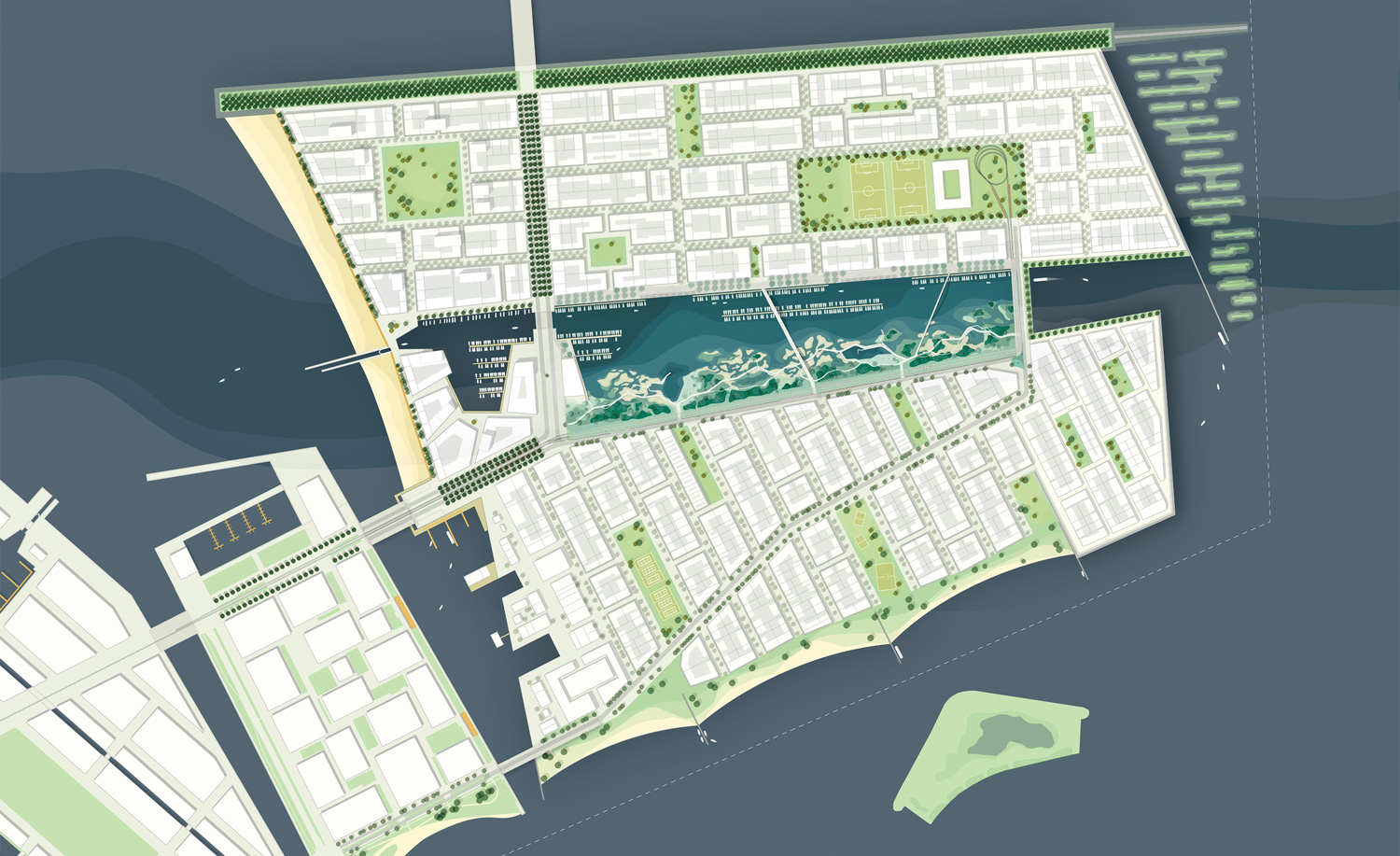

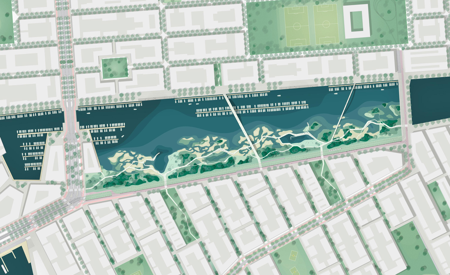

The sketch design for ‘het Oog’ (The Eye) follows the elaboration of the urban development plan for IJburg phase 2, or Strandeiland, on which the Municipality of Amsterdam and DELVA previously collaborated. Het Oog is a large inland water that is situated on top of the historic archaeological gully.
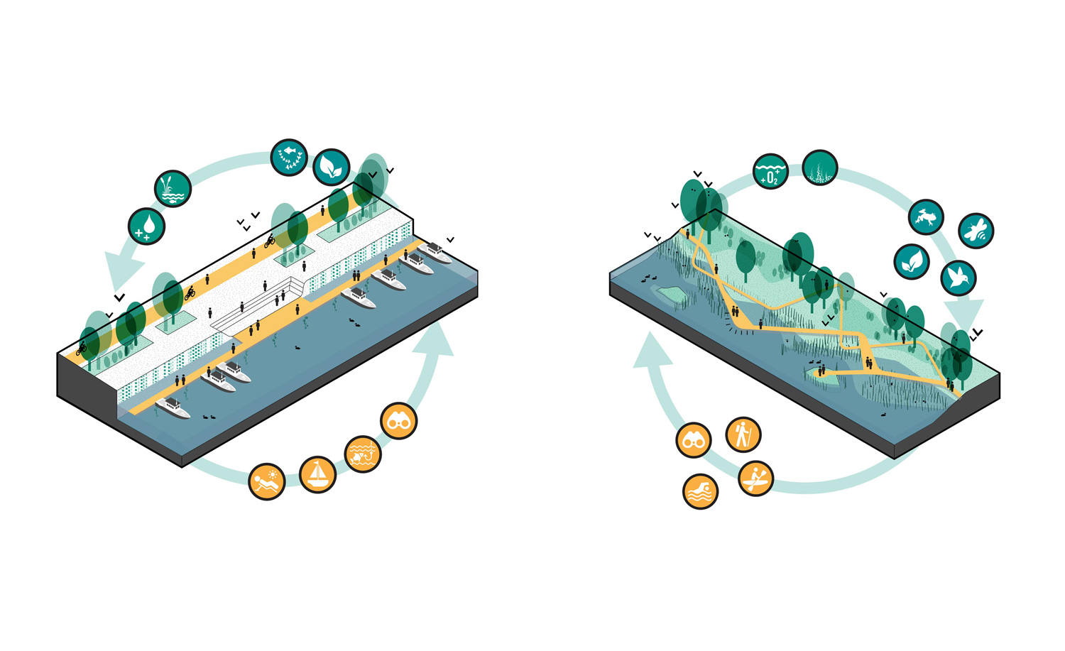
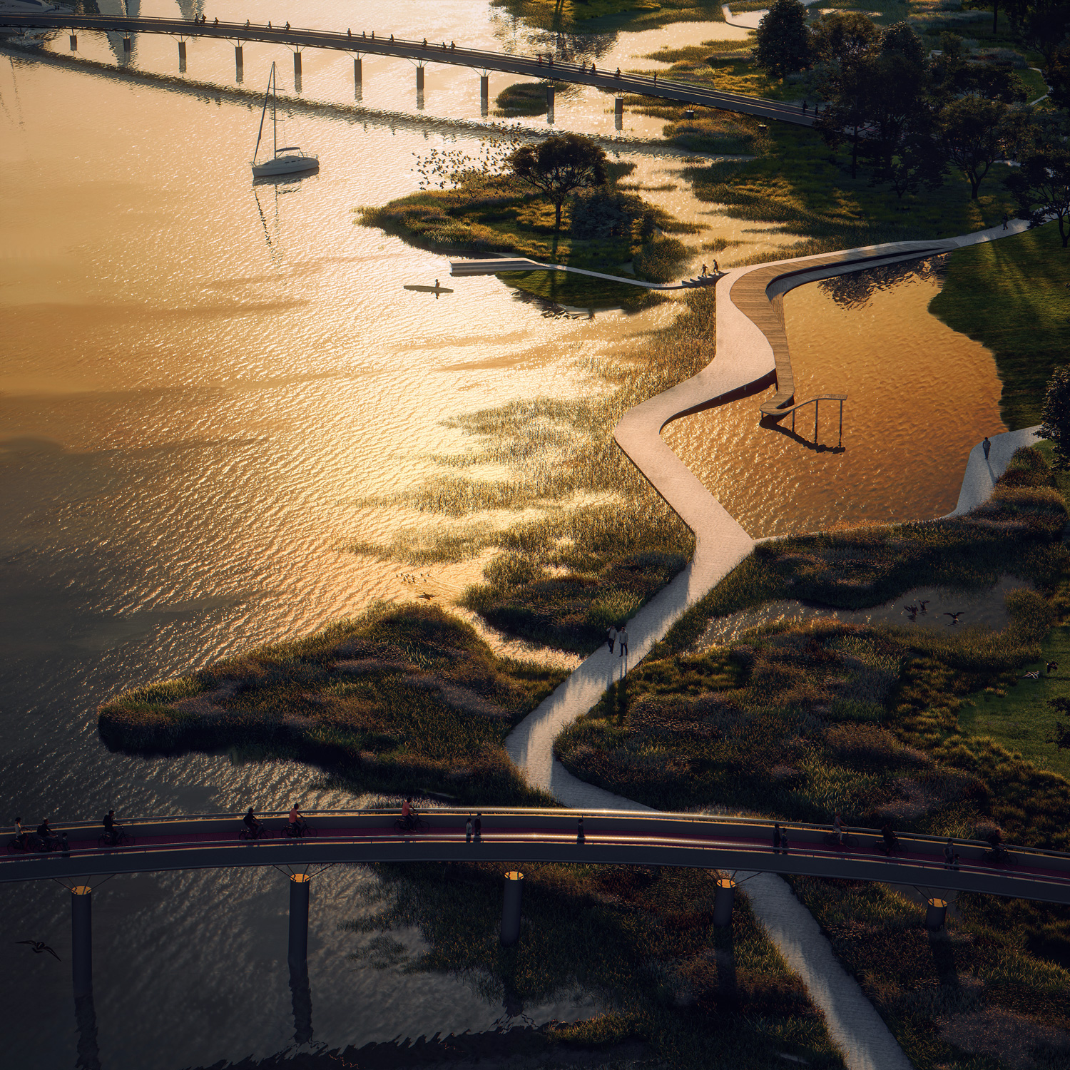
Het Oog is the ‘living room of Strandeiland’ and responds to both identities of both the Pampus and Muiderbuurt. She brings these together and thus forms the blue heart of Standeiland: a place of stay, meeting and activity for the residents, but also for ecology, water quality and the creation of a diverse urban nature. Het Oog facilitates a particularly diverse program that is always water-related, and in which the hard quay on the north side contrasts sharply with the soft bank on the south side.
Within this study, the focus is on the south side of the Eye, in order to spatially shape the soft bank there into a perceptible (underwater) landscape park. This statement is inscribed in the manual ‘public space Strandeiland’ that is currently being drawn up by the Municipality of Amsterdam. The sketch design lays down the basic principles for the design language, use and general atmosphere of the (underwater) landscape park.
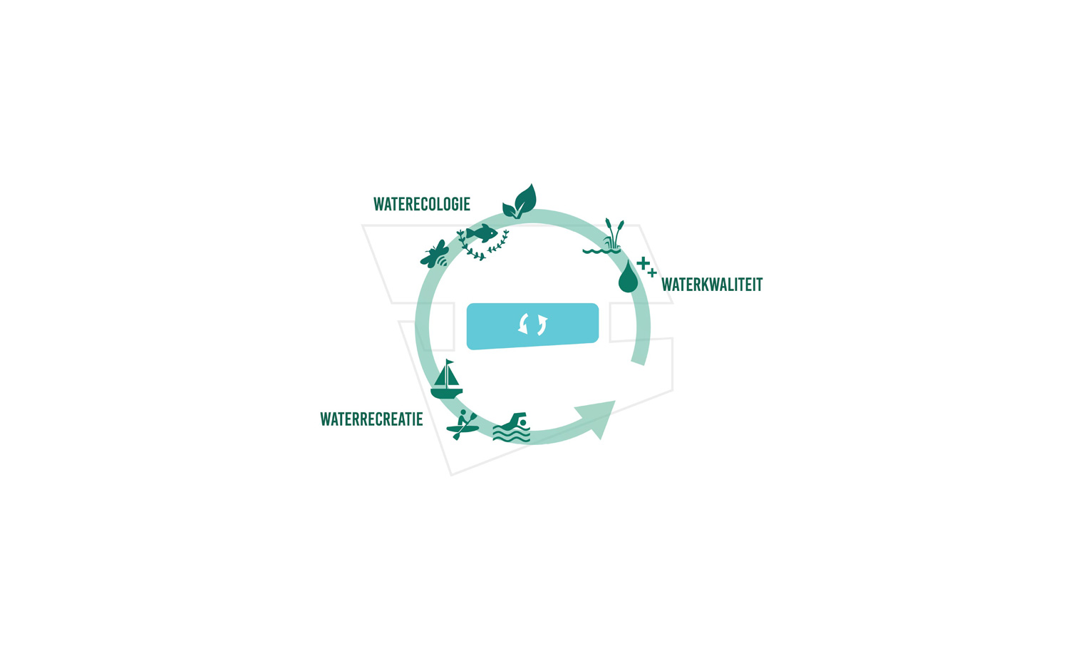
Het Oog reconciles water quality, ecology and recreation
The inland water is not a natural water surface: it is completely ‘manmade’ and cannot derive its quality from the context or the landscapes behind it. The inland water must therefore generate its own identity from the role it fulfills for Strandeiland.
This identity arises from the inland water that will serve the city as much as possible and provides ecosystem services at the level of water quality (natural purification of rainwater from the island), water ecology (the creation of a robust, ecological stepping stone for fauna and flora ), and water recreation (creating water-related recreation places for the residents of Strandeiland). The southern side is being developed as a wide and varied natural bank where maximum use is made of all three themes (water quality, water recreation, water ecology).
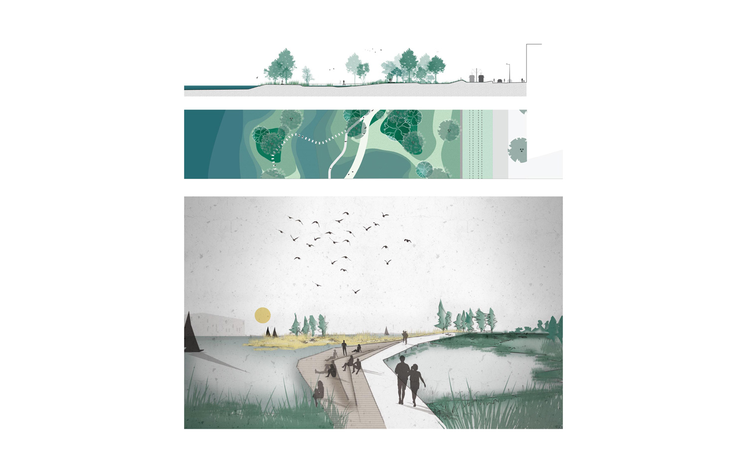
Reed beds, underwater plants and microbes naturally purify the water. Shrubs, trees, and semi-submerged plants attract birds, insects and amphibians to the park. In addition, an intertwined path structure will be linked to programmatic functions that make the park accessible and experienceable.
Water quality: organic purification process
A measure with a major impact in preventing deterioration in water quality resulting in algal blooms, low oxygen and dead water is the use of biological water purification. By using specific emergent and submerged plants, the quality of the water can be naturally maintained.
The water that ends up in the Eye via the Muiderbuurt and Pampusbuurt is often contaminated because it is permeated with nitrogen and phosphorus, originating from green roofs, leaf litter, exhaust gases, etc. hollow reed stems are injected into the water. This extra oxygen binds with the nitrogen and phosphorus to form nitrates and phosphates. Bacteria absorb these and serve as nutrients for the growth and development of submerged and semi-submerged aquatic plants. This process reduces the nitrate and phosphate content in the water and reduces the risk of poor water quality.
Water ecology: maximizing ecological banks
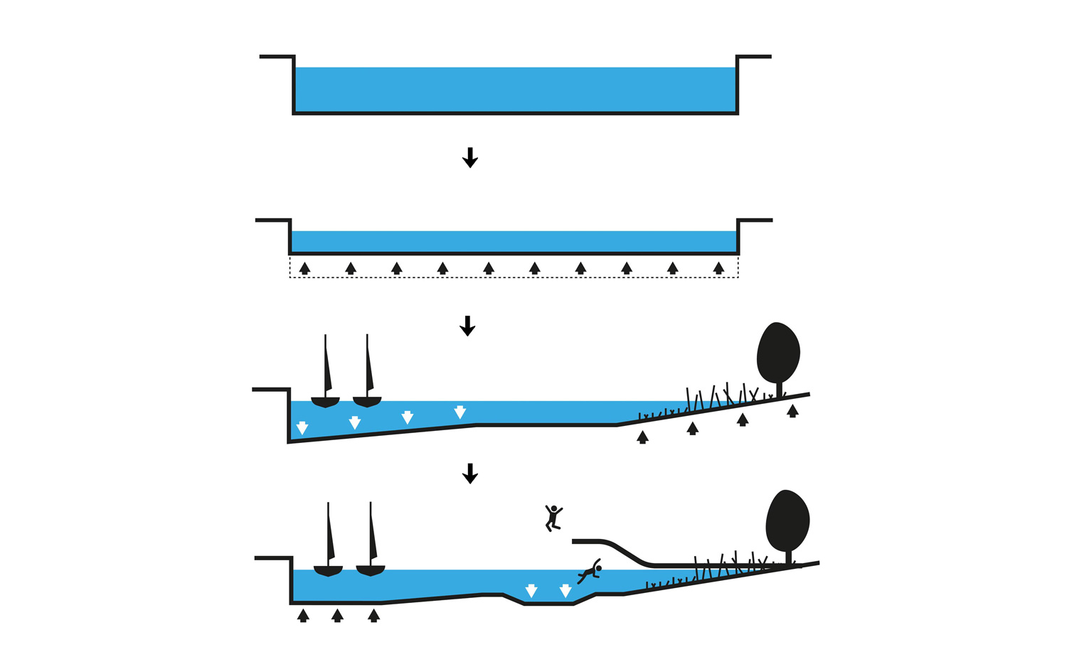
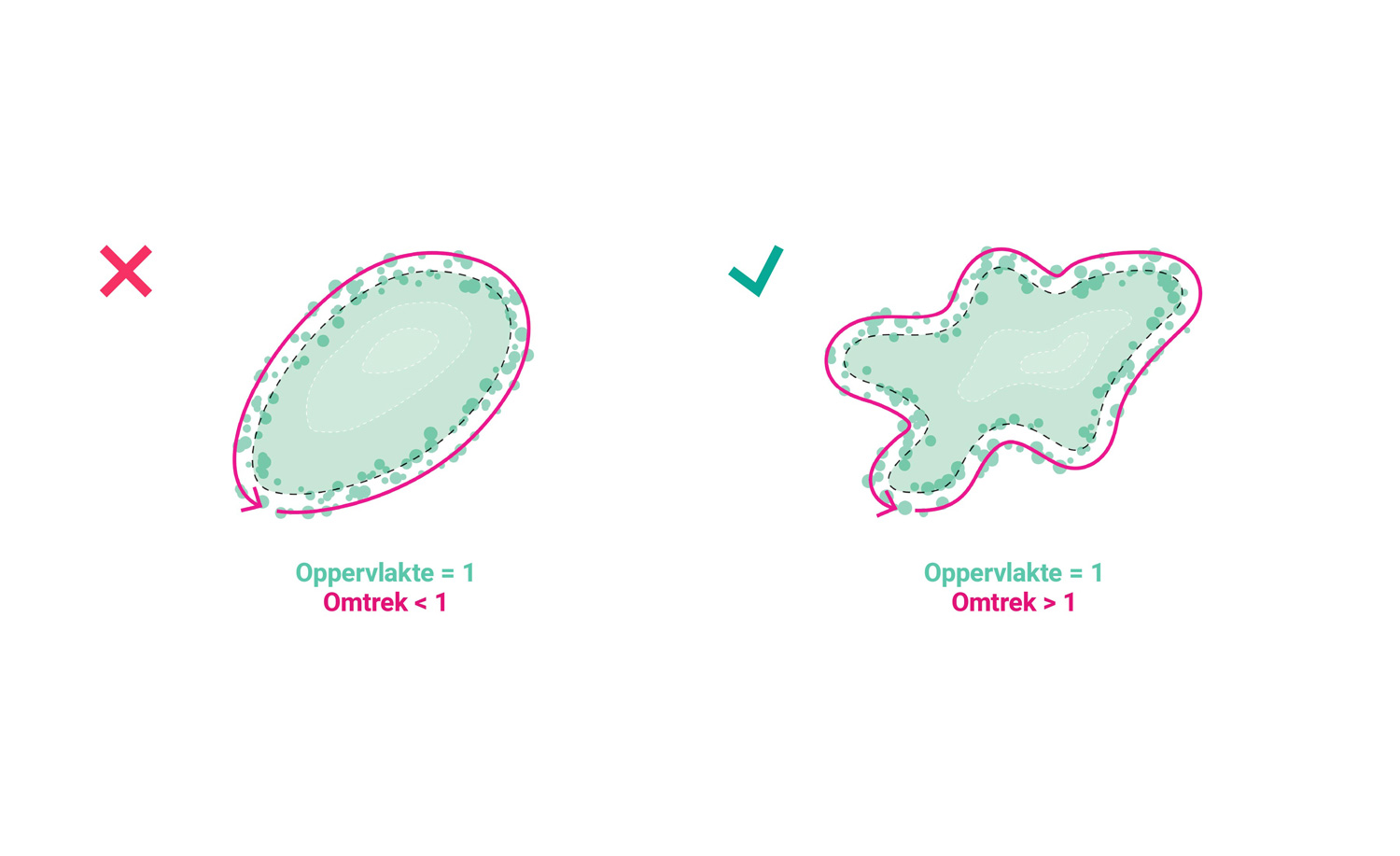
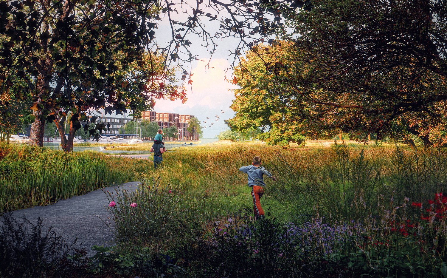
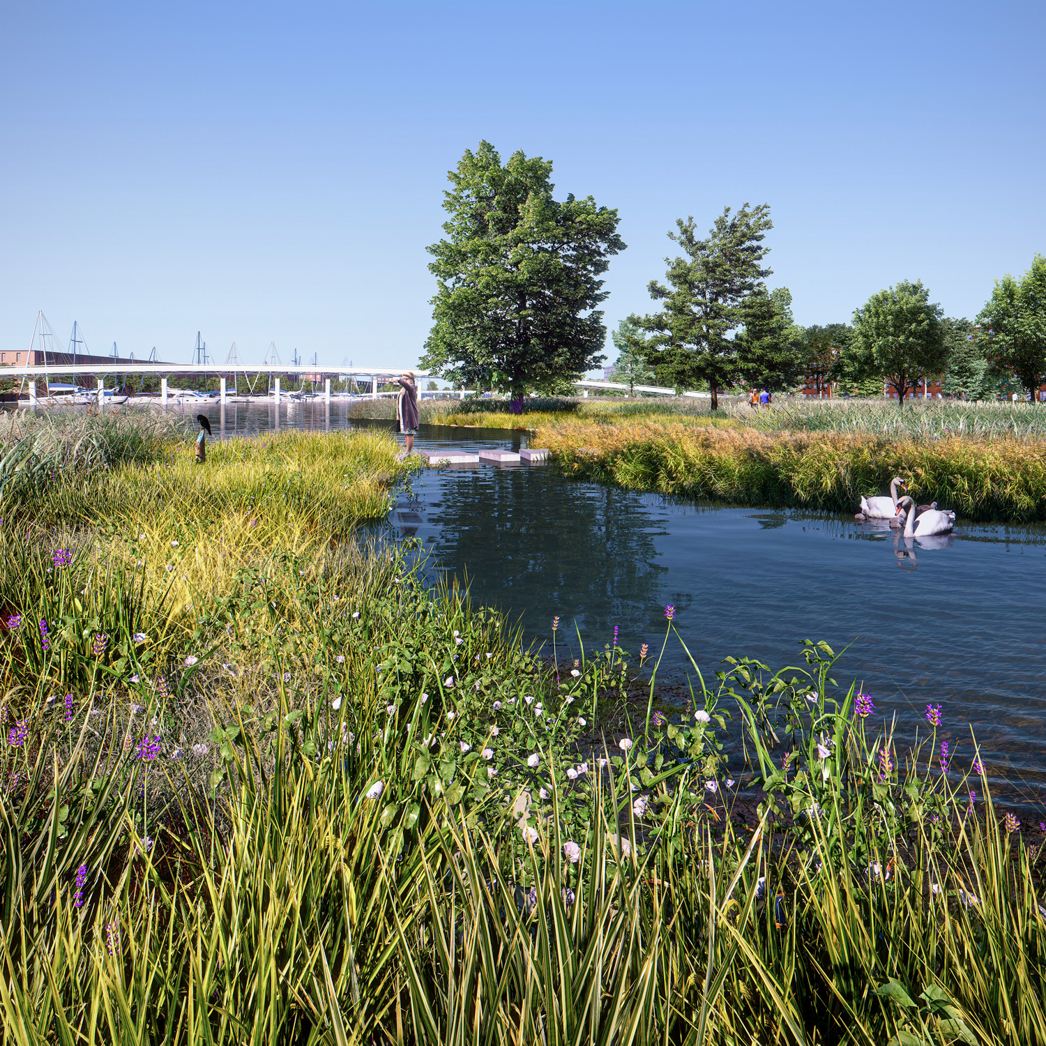
The (underwater) landscape park has a major contribution to make in the natural purification of the water of the Eye. In order to maximize the number of water-purifying plants and reed banks (always semi-submerged), it is decided to work with whimsical, natural shapes. This whimsical shape is accompanied by the creation of a series of large and small islands, wetlands etc. to blur the boundary between water and land as much as possible. This creates more bank length, and therefore more space for semi-submerged plants, than if the bank were tighter and more simple.
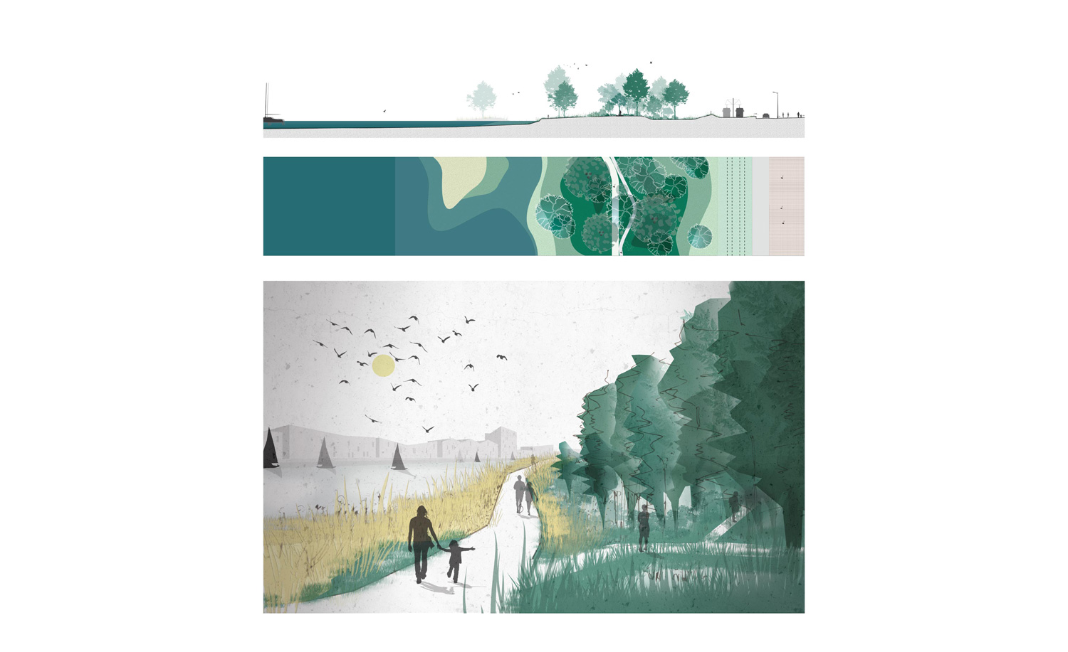
The soft transition between land and water is characterized by three types of landscapes or facilities, each of which has a specific role within the entire (sub) water landscape and each attract and facilitate its own fauna and flora. Three zones are distinguished:
– The land zone: it is always above the highest water level
– The riparian zone: it lies both above and below the (slightly fluctuating) water level and contains vegetation that is half submerged
– The water zone: this is completely below the lowest water level
Water recreation: integration of functions in path structure
The path structure forms the beating heart of the (underwater) landscape park. From here every visitor can fully experience and discover the park. They have opted for their own design language, which is a combination between a more romantic and traditional approach found in English landscape architecture, and a sleek, modern contemporary approach to straight lines and sharp angles. This results in a playful design language with short, straight sections and rounded corners that constantly offers the visitor new views and experiences.
The path structure does not only consist of paths, but also of resting places, play elements and smaller nature paths. Each special element is therefore incorporated within the same design language so that everything forms one coherent whole. These elements invite various forms of water-related recreation and offer relaxation and play space for young and old.
Atmospheres within the plan
Inland water is the central figure in the urban design of Strandeiland. This makes it important to emphasize its connecting function by working with long sight lines that become noticeable from important points in the plan. Sightlines are created from the green fingers of the
Muiderbuurt, whose recreational program is also physically extended into the (underwater) landscape park. In addition, a long visual relationship also arises when entering Strandeiland, or from the dyke on the east side, which separates the inland water from the IJ.
The (underwater) landscape park is strongly anchored to its surroundings at 5 strategic points. The number of crossings between the park and its surroundings was limited to five because of the tram track, whereby the crossings must be reduced to a minimum. Finally, a great diversity of open and more closed places is created in the park. The visitor is guided naturally along the most important places in the park. More hidden, secluded spots are there to be discovered via more adventurous nature trails, and ensure that residents of Strandeiland can permanently discover new places in the park or to escape completely from the bustling city life.
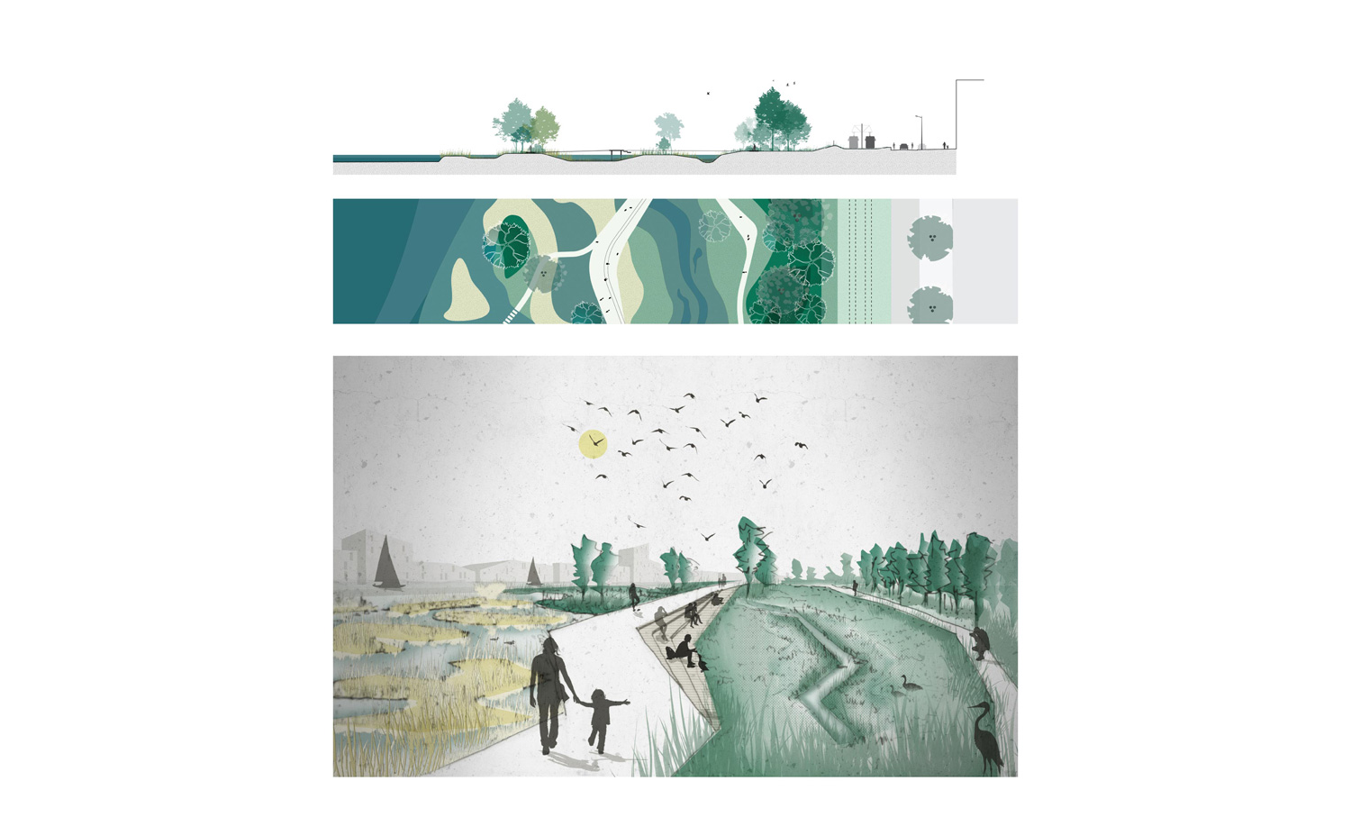
On the west side, the park starts with a denser wooded part that immediately shields the visitor from the urban environment and offers a wide view towards the open water. The main route lies between the natural bank with reeds and (low) grasses and the small forest.
Narrower side paths give access to the forest with rough undergrowth to give the visitor the opportunity to isolate himself as much as possible from urban life.
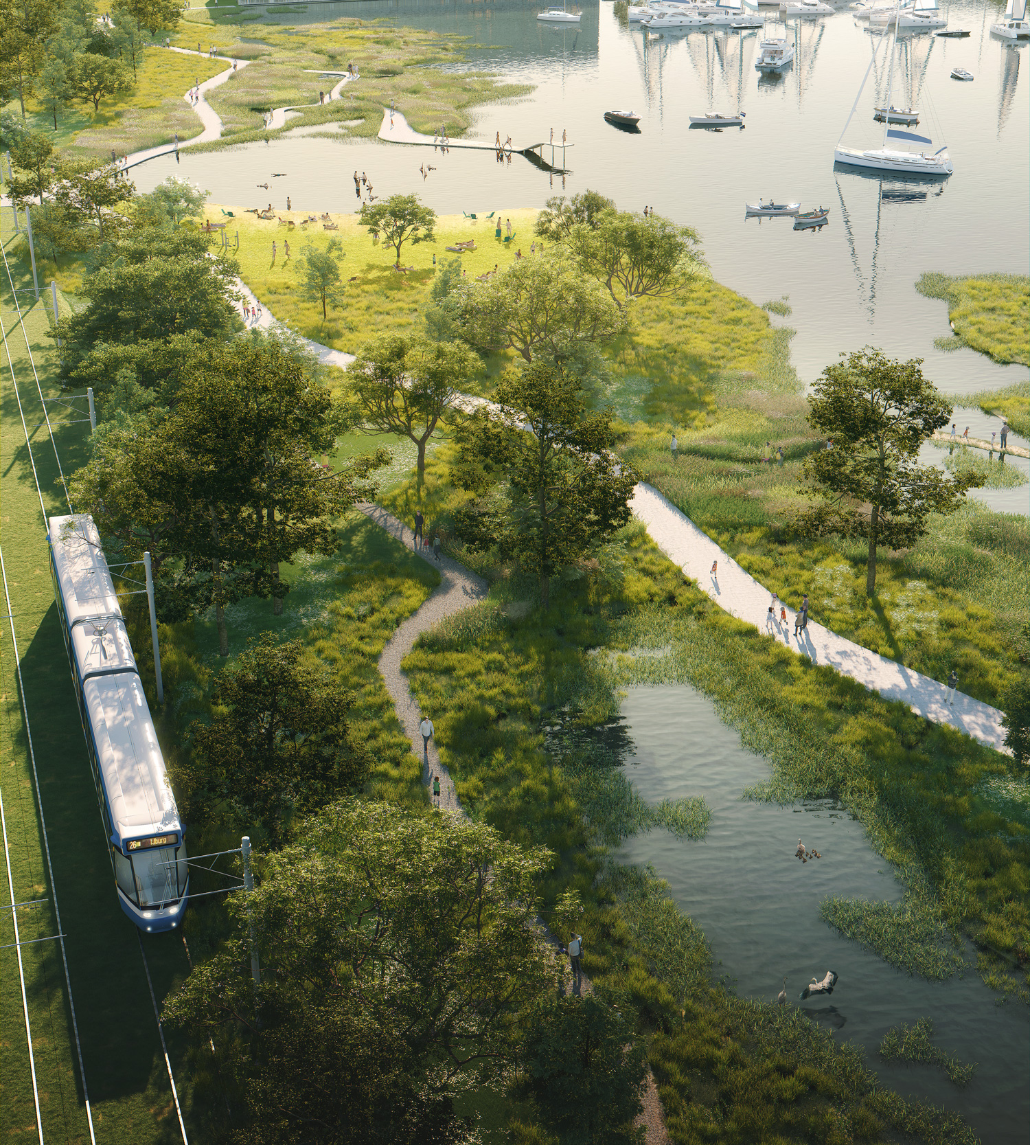
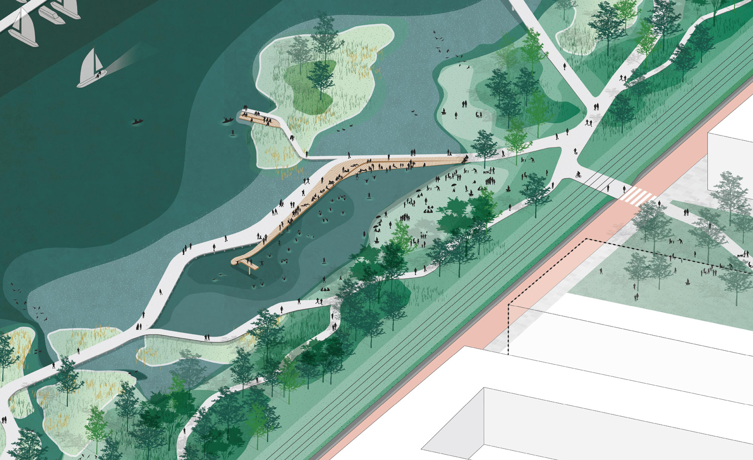
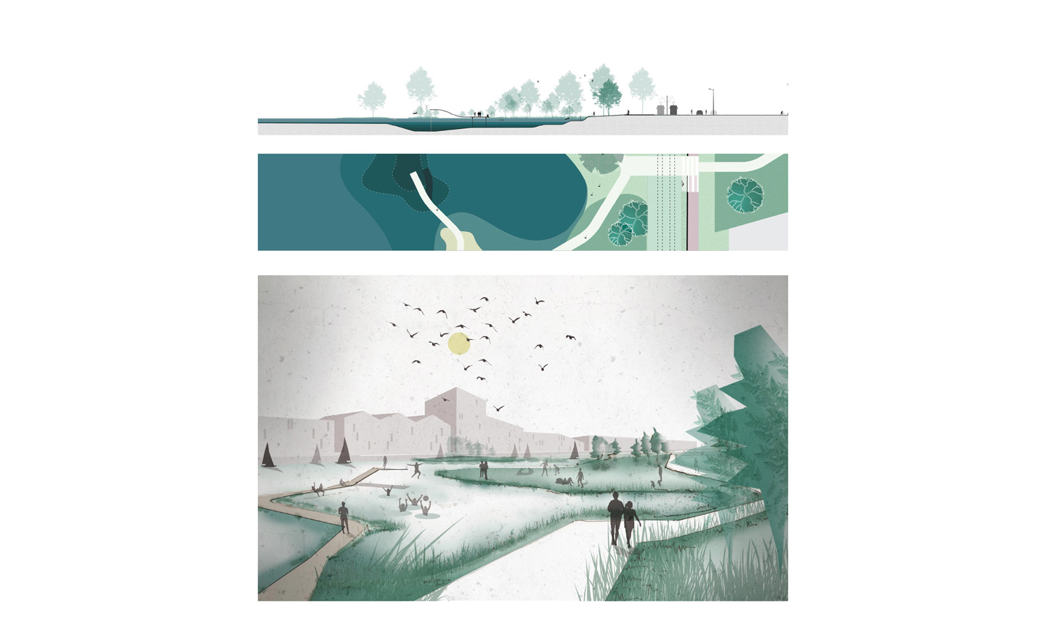
When you walk a little further you suddenly come to an open bay that emphasizes the vastness and breadth of the water. Here the main route jumps into a continuous part (which connects with the green finger in the Muiderbuurt), and a dead-end part, which is designed as a sun deck, swimming area and springboard. On the other side of the bay there is a large, open sunbathing area oriented to the afternoon and evening sun.
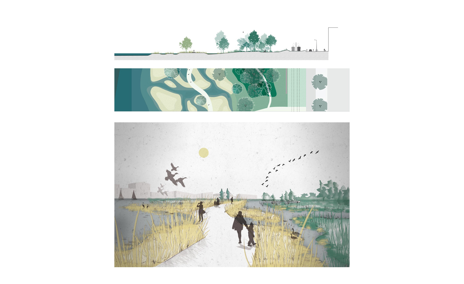
After the natural bay, the main route continues much further from the quay of the Muiderbuurt. In this third part of the park, the main route moves along a wetland on the right and several small reed islands on the left. The main route incorporates several staircases that are oriented to the south and look out over the wetland. A secondary, semi-paved nature trail runs along the edge of the forest on the other side of the wetland and brings visitors very close to the habitat of water birds and ducks.
The main route continues and takes more and more distance from the quay of the Muiderbuurt. In this part people walk over and between a large number of reed islands. More open places with views over the water alternate with very dense, narrower places where one feels completely enclosed by the high reeds.
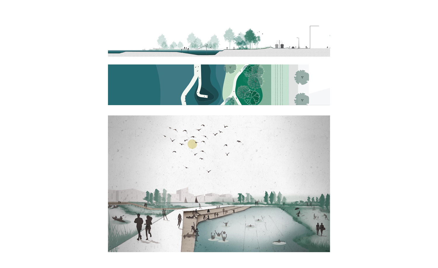
When one has passed the high reeds, the (underwater) landscape park suddenly opens up completely again into a large, well-equipped swimming and recreation zone. Here part of the water is enclosed as a closed swimming zone. The swimming area is delimited by the main path that also serves as a south-oriented sun deck and an open grassy meadow on the other side. A shallow part also gives the smallest among us the chance to enjoy the water. A little further on, the main route still originates in a side path that takes the visitor to a small island where a dock for canoes is provided.
All the way to the east of the park, the experience is rounded off with the main route that goes over a small bay and gives space to a seating stand that offers a view towards the setting sun. Groups of islands before and after the seating stand are only accessible via hidden narrower paths and stepping stones, to completely unwind here, completely surrounded by the water.